
Anderson WALL Map, South Carolina, America.
$249.95
In stock
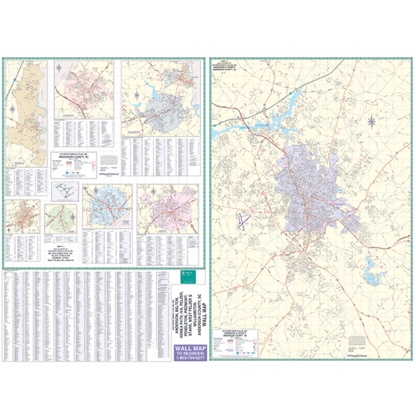
Scale 1:10,700. Size 46" W x 64" H. Laminated. The Anderson County, South Carolina Wall Map by Accurate Maps. Printed in color with a markable/washable--laminated surface. Street index provided on the face of the map. Framing rails are included on top and bottom for easy wall mounting. Railed wall maps can be turned into pull down maps on spring rollers for an additional $40. Area of coverage: All of Anderson County with insets of Anderson, Belton, Honea Path, Williamston, Pendleton, and Clemson. Details include all streets and highways, government buildings, airports, water features, fire/police stations, hospitals, shopping centers, educational facilities, railroads, recreational parks, golf/country clubs, post offices, ZIP codes, and points of interest.
Scale 1:10,700. Size 46" W x 64" H. Laminated. The Anderson County, South Carolina Wall Map by Accurate Maps. Printed in color with a markable/washable--laminated surface. Street index provided on the face of the map. Framing rails are included on top and bottom for easy wall mounting. Railed wall maps can be turned into pull down maps on spring rollers for an additional $40. Area of coverage: All of Anderson County with insets of Anderson, Belton, Honea Path, Williamston, Pendleton, and Clemson. Details include all streets and highways, government buildings, airports, water features, fire/police stations, hospitals, shopping centers, educational facilities, railroads, recreational parks, golf/country clubs, post offices, ZIP codes, and points of interest.
| Item Price | $249.95 + $24.80 p&h (add $40 for spring rollers) |
|---|
Write Your Own Review