
Boston Harbor Islands National Recreation Map, Massachusetts, America.
$16.95
In stock
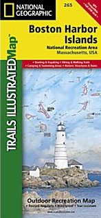
Scale 1:30,000. Size 26"x38". National Geographic edition. Our new detailed recreation map for the Boston Harbor Islands National Recreation Area is a two-sided, waterproof map which covers all 34 of the harbor islands plus shoreline parks, downtown Boston, access and ferry interpretive information and neighboring communities. The front side contains both bathymetry and topography—making it the perfect multi-functional map for kayaking, hiking, fishing, wildlife viewing and more. This beautiful map is a perfect souvenir to remember your trip to the park as well as a highly functional tool for those that recreate here frequently.
Users will find clearly marked ferry terminals and routes, water taxi stops, boat ramps, moorings, beaches, historic sites, campgrounds, trails, forts, and hundreds of place names. A UTM and Latitude/Longitude grid, as well as compass rose, scale bar, and marine navigation markers (buoys, lights, and soundings) will keep you pointed in the right direction.
| Item Price | $16.95 |
|---|
Write Your Own Review