
Canyonlands National Park, Needles District, Road and Topographic Map, Utah, America.
$17.95
In stock
Scale 1:62,500. Size 26"x37". Trails Illustrated edition. Printed on waterproof, tear-resistant, lightweight, paper-like plastic. This map includes Canyonlands National Park, the Island in the Sky district, the Needles district, and the Maze district. The map also includes the Colorado River, the Green River, Indian Creek Wilderness, Bridger Jack Mesa Wilderness, Butler Wash Wilderness, Canyon Rims Recreation Area, and fascinating information about the park's archaeology. The map has been updated to reflect road closings, new trails, and campground relocation, and includes detailed trail information, points of interest, trailheads, picnic areas, facilities, and more. Includes UTM grids for use with your GPS.
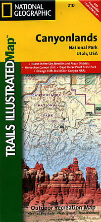
Scale 1:62,500. Size 26"x37". Trails Illustrated edition. Printed on waterproof, tear-resistant, lightweight, paper-like plastic. This map includes Canyonlands National Park, the Island in the Sky district, the Needles district, and the Maze district. The map also includes the Colorado River, the Green River, Indian Creek Wilderness, Bridger Jack Mesa Wilderness, Butler Wash Wilderness, Canyon Rims Recreation Area, and fascinating information about the park's archaeology. The map has been updated to reflect road closings, new trails, and campground relocation, and includes detailed trail information, points of interest, trailheads, picnic areas, facilities, and more. Includes UTM grids for use with your GPS.
| Item Price | $17.95 |
|---|
Write Your Own Review