
Capitol Reef and Fish Lake North, Road and Recreation Map, Utah, America.
$17.95
In stock
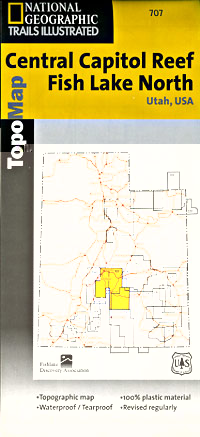
Scale 1:90,000. Size 25"x37". Trails Illustrated edition. Printed on waterproof, tear-resistant, lightweight, paper-like plastic. This Trails Illustrated topographic map is the most comprehensive recreational map for Utah's Fish Lake North/North & Central Capitol Reef area. Coverage includes: Fishlake National Forest; Capitol Reef National Park; Waterpocket Fold and Fremont Junction; Thousand Lake Mountain; Monroe Mountain; Gooseberry Area and Boulder Mountain; Fish Lake; Bown's; Sheep Valley and Rocky Ford Reservoirs; Great Western Trail and more.
Scale 1:90,000. Size 25"x37". Trails Illustrated edition. Printed on waterproof, tear-resistant, lightweight, paper-like plastic. This Trails Illustrated topographic map is the most comprehensive recreational map for Utah's Fish Lake North/North & Central Capitol Reef area. Coverage includes: Fishlake National Forest; Capitol Reef National Park; Waterpocket Fold and Fremont Junction; Thousand Lake Mountain; Monroe Mountain; Gooseberry Area and Boulder Mountain; Fish Lake; Bown's; Sheep Valley and Rocky Ford Reservoirs; Great Western Trail and more.
| Item Price | $17.95 |
|---|
Write Your Own Review