
French Broad and Nolichucky Rivers, Road and Recreation Map, Tennessee, America.
$17.95
In stock
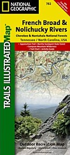
Scale 1:63,000. Size 26"x38". Trails Illustrated edition. Printed on waterproof, tear-resistant, lightweight, paper-like plastic. This Trails Illustrated topographic map is the most comprehensive and complete recreational map for Tennessee's Cherokee National Forest, Northern Districts, French Broad & Nolichucky Rivers area. Coverage includes: Cherokee National Forest/Northern Districts; Greenville and Newport; Sampson Mountain Wilderness Area; boating access points on the Nolichucky and French Broad Rivers; Foothills Parkway and the Appalachian Trail.
Scale 1:63,000. Size 26"x38". Trails Illustrated edition. Printed on waterproof, tear-resistant, lightweight, paper-like plastic. This Trails Illustrated topographic map is the most comprehensive and complete recreational map for Tennessee's Cherokee National Forest, Northern Districts, French Broad & Nolichucky Rivers area. Coverage includes: Cherokee National Forest/Northern Districts; Greenville and Newport; Sampson Mountain Wilderness Area; boating access points on the Nolichucky and French Broad Rivers; Foothills Parkway and the Appalachian Trail.
| Item Price | $17.95 |
|---|
Write Your Own Review