
Grand Gulch Plateau, Road and Recreation Map, Utah, America.
$17.95
In stock
Scale 1:63,000. Size 25"x37". Trails Illustrated edition. Printed on waterproof, tear-resistant, lightweight, paper-like plastic. This Trails Illustrated topographic map is the most comprehensive and complete recreational map for Utah's Grand Gulch Plateau area. Coverage includes BLM/San Juan Resource Area; Grand Gulch Primitive Area; Grand Flat, Northern Glen Canyon National Recreation Area, Valley of the Gods, Cedar Mesa, Snow Flat, Grand Flat and Comb Ridge; First, Fish and Owl Creek, Polly Mesa and San Juan River.
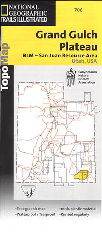
Scale 1:63,000. Size 25"x37". Trails Illustrated edition. Printed on waterproof, tear-resistant, lightweight, paper-like plastic. This Trails Illustrated topographic map is the most comprehensive and complete recreational map for Utah's Grand Gulch Plateau area. Coverage includes BLM/San Juan Resource Area; Grand Gulch Primitive Area; Grand Flat, Northern Glen Canyon National Recreation Area, Valley of the Gods, Cedar Mesa, Snow Flat, Grand Flat and Comb Ridge; First, Fish and Owl Creek, Polly Mesa and San Juan River.
| Item Price | $17.95 |
|---|
Write Your Own Review