
Greek Islands Road and Illustrated Pictorial Map.
$12.95
In stock
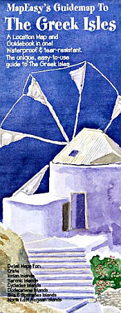
MapEasy edition. Shows all the Greek Islands, neatly separated into island groups, including the: Ionian Islands (east coast), Saronic Islands (south of Athens), Crete (south of Greece), Evia & Sporades Islands (west central coast), Cyclades Islands (between Greece & Turkey), Dodecanese Islands (off Turkey southwest coast), and the Northeast Aegean Islands (off Turkey northwest coast) . Perfect for the intrepid or armchair traveller, this charming map combines the best of a guidebook and a location map, all in one. Printed on tear-proof, water-resistant, lightweight, paper-like plastic, that is incredibly durable. Also includes extensive notations and interesting details about all the important tourist areas. You'll love this map!
MapEasy edition. Shows all the Greek Islands, neatly separated into island groups, including the: Ionian Islands (east coast), Saronic Islands (south of Athens), Crete (south of Greece), Evia & Sporades Islands (west central coast), Cyclades Islands (between Greece & Turkey), Dodecanese Islands (off Turkey southwest coast), and the Northeast Aegean Islands (off Turkey northwest coast) . Perfect for the intrepid or armchair traveller, this charming map combines the best of a guidebook and a location map, all in one. Printed on tear-proof, water-resistant, lightweight, paper-like plastic, that is incredibly durable. Also includes extensive notations and interesting details about all the important tourist areas. You'll love this map!
| Item Price | $10.95 |
|---|
Write Your Own Review