
Louisville WALL Map.
$240.95
In stock
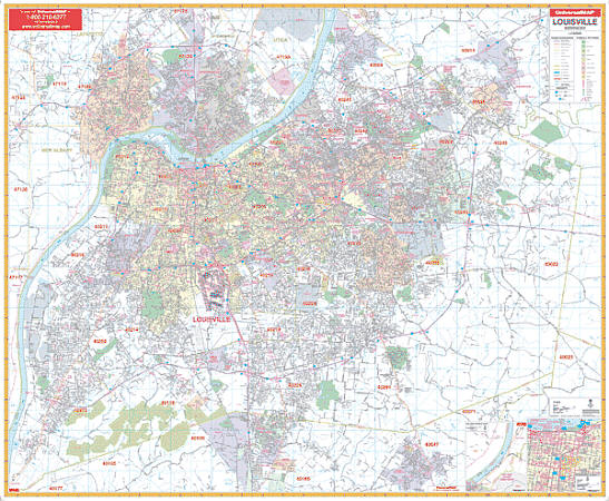
Scale 1:2,000. Size 63" W x 54" H. Laminated. The Louisville/Jefferson County, Kentucky Wall Map by Universal Map includes the city of Louisville and adjacent areas. Printed in color on a laminated surface that is both markable and washable. Street indexing appears in a separate book. Framing rails are included on top and bottom for easy wall mounting. The area of coverage ranges: North: to include New Albany-Clarksville and Jeffersonville, Indiana; also a portion of Oldham County to include River Bluff, Pewee Valley, Crestwood, and surrounding areas; South: to include Hillview, Pioneer Village, and Mount Washington in Bullet County; East: to Shelby County line; West: across the Ohio River to show portions of the Indiana side including Edwardsville. Details featured with this map include all streets, post offices, hospitals, railroads, mileage circles, airports, cemeteries, shopping centers, water features, recreational parks, government buildings, fire and police stations, educational facilities, golf course and country clubs, ZIP code boundaries, and other points of interest. Railed wall maps can be turned into pull down maps on spring rollers for an additional $40.
Scale 1:2,000. Size 63" W x 54" H. Laminated. The Louisville/Jefferson County, Kentucky Wall Map by Universal Map includes the city of Louisville and adjacent areas. Printed in color on a laminated surface that is both markable and washable. Street indexing appears in a separate book. Framing rails are included on top and bottom for easy wall mounting. The area of coverage ranges: North: to include New Albany-Clarksville and Jeffersonville, Indiana; also a portion of Oldham County to include River Bluff, Pewee Valley, Crestwood, and surrounding areas; South: to include Hillview, Pioneer Village, and Mount Washington in Bullet County; East: to Shelby County line; West: across the Ohio River to show portions of the Indiana side including Edwardsville. Details featured with this map include all streets, post offices, hospitals, railroads, mileage circles, airports, cemeteries, shopping centers, water features, recreational parks, government buildings, fire and police stations, educational facilities, golf course and country clubs, ZIP code boundaries, and other points of interest. Railed wall maps can be turned into pull down maps on spring rollers for an additional $40.
| Item Price | $240.95 + $24.80 p&h (add $40 for spring rollers) |
|---|
Write Your Own Review