
Arizona Road Maps | Detailed Travel Tourist Driving
Get to Know about Arizona Through Elaborate and Informative Maps
Arizona is the 6th biggest and the 14th densely populated state in the US. It is situated in the Rocky Mountainous southwestern area of the United States. The whole area of this state is 114,000 sq mi (295,260 sq km), out of which land occupies 113,508 sq mi (293,986 sq km) plus 492 sq mi (1,274 sq km) is of inland water. At times the state of Arizona is referred as America’s Italy.
Arizona is spread over an area of 113,990 square miles. The boundaries of the state are shared with the US states of California, Utah, Nevada, New Mexico and a single common point with Colorado. The borders of the state are shared with Mexico as well. Phoenix, the biggest state of Arizona is the capital as well. Arizona is, in addition, acknowledged as the Grand Canyon State. A few of the well-maintained meteorite impact sites of the world is also found in Arizona.
Tourists spots of Arizona
Grand Canyon which its stunning scenery is one among the most popular tourist spots. The wrecks of 3 early Spanish colonial missions are being conserved at the National Historical Park of Tumacacori. 30 different and varied species of cactus can be found at Organ Pipe Cactus National Monument. There are more places which are worth visiting like Jerome, Havasu Falls, Bisbee, Canyon De Chelly National Monument, Petrified Forest National Park, Saguaro National Park, among others.
Arizona Map
Arizona, a very popular weekend escape spot for those who live in the desert is a place to escape the wrath of the sun during summer from the Phoenix plus Scottsdale region. You can very easily and interestingly know a lot about Arizona with our detailed and instructive map. The Map of Arizona will acquaint you with each and every minute details of Arizona.
Arizona Road Maps for Tourists and TravelersDetailed Road Map of ArizonaBuy travel maps for Arizona tourist attractions, road trips, street guide, driving directions and more |
Arizona
- $17.95
Item Code : ITMB4879
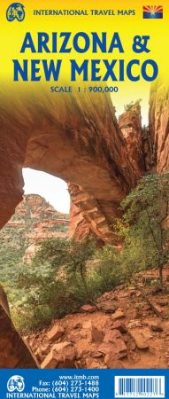
Scale 1:900,000. Size 27"x39". International Travel Maps edition.
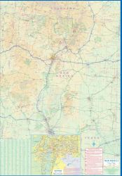
ITMB is pleased to announce the release of our updated Arizona and New Mexico maps, printed in a double-sided format, with each state having its own side.
This version includes two separate covers, one for each state, to enhance marketing possibilities, and the addition of two Top Attractions listings, one for each state. The Arizona side has a detailed inset map of Flagstaff, showing the path of Route 66 through the city streets. The New Mexico side includes a large inset of Albuquerque, also including the Route 66 passageway through the city.
- $10.95
Item Code : UNIV4948
 Scale 1:1,060,000. Size 22"x38". Universal Map edition. Arizona road map.
 - $16.95
Item Code : NATL4950
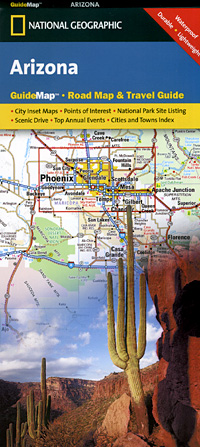
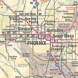
 Scale 1:1,700,000. Size 18"x25". National Geographic edition. Arizona road map. The front side features insets of Bullhead City/Laughlin, Yuma, Flagstaff, Tucson, Downtown Phoenix, Saguaro National Park, and Petrified Forest National Park. The back includes maps and information for Phoenix and Grand Canyon National Park, points of interest, scenic drives, and Park Service sites in Arizona.
 - $14.95
Item Code : GRTA4946
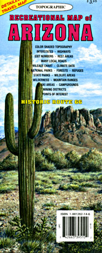
 Scale 1:790,000. Size 29"x37". GTR Mapping Company edition. Route 66 highlighted! Detailed travel map - Interstates, exit numbers, highways, more local roads than typical road maps. Topographic contours each 1,000 feet. Color shaded each 2,000 feet above 4,000 feet. Features include national forests, wilderness, campgrounds, parks, state wildlife areas, ski areas, mining districts, points of interest, and more.
 - $11.95
Item Code : AMER4952
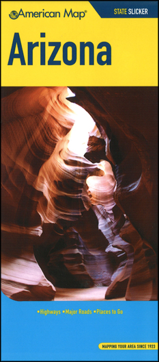 Size 5"x10" (folded). American Map Company edition. Laminated. At home, at work or on the road, American Map atlases are a driver's best friends. Accurate, up-to-date and easy-to-read, street and road atlases provide convenient, clear reference for navigating close to home or points unknown. Arizona road map.
 - $11.95
Item Code : RAND22483
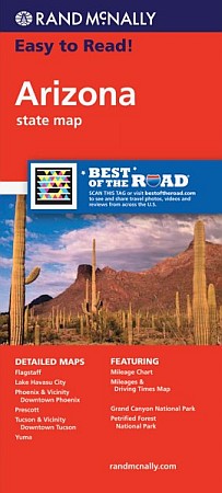 Size 28"x40". Rand McNally edition. Rand McNally's Easy To Read State Folded Map is a must-have for anyone traveling in and around Arizona, offering unbeatable accuracy and reliability at a great price. Our trusted cartography shows all Interstate, U.S., state, and county highways, along with clearly indicated parks, points of interest, airports, county boundaries, and streets. The easy-to-use legend and detailed index make for quick and easy location of destinations. You'll see why Rand McNally folded maps have been the trusted standard for years.
 - $17.95
Item Code : ITMB4780
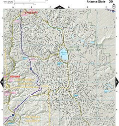
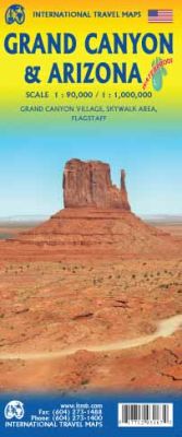 Scale 1:1,000,000. Size 27"x39". International Travel Maps edition. This is a double-sided map, with a very good map of the State of Arizona on one side and an excellent exploratory map of the Grand Canyon on the other. The map can be marketed equally well as a State map or as a recreational/touristic map. Needless to say, the deep canyons carved by the Colorado River over millennia have created one of the great natural wonders of the world. This is a ‘must-see-before-I-die’ travel experience, visited by millions of people each year. Our map shows access areas, viewpoints, trails leading down to the valley floor, and the man-made attractions common to a major touristic site. The other side covers all of Arizona, with bits of Nevada, Utah, California, and Mexico and shows wilderness campgrounds, parks, attractions, and a large inset map of Flagstaff for those driving Route 66. The state has Tucson, Phoenix, Sedona, and lots of desert. The main attractions are highlighted.
 - $10.95
Item Code : GPAC22484
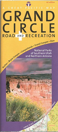 Great Pacific Recreation Maps edition. Comprehensive coverage of Southern Utah (south of I-70) and Northern Arizona Detailed inset maps of Arches, Bryce Canyon, Canyonlands, Grand Canyon and Zion National Parks + Grand Canyon Village. "Grand Canyon Regional Access Map" shows highway, scheduled airline and Amtrak access to the Grand Canyon National Park area. Quality cartography by California State Automobile Association (CSAA) and Great Pacific Recreation & Travel Maps. Comprehensive Community and recreation indexes. Phone & website and National Park directories. Map features include an amazing array of stunning, geographic features (mountains, buttes, canyons, basins, deserts, etc.), airports, BLM recreation areas, hiking trails, marinas, museums & historic places, off-road vehicle areas, ranger stations, Scenic Byways & Backways, scenic overlooks, State Parks, US National Forests, US Forest Service Roads, visitor centers, wilderness areas and wildlife watching areas. Comprehensive mileage chart and mileage map.
 - $28.95 + $7.50 p&h
Item Code : DELR4959
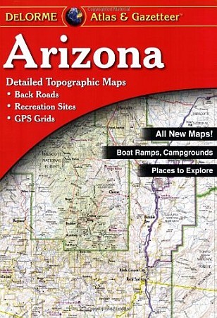
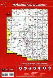 Scale 1:250,000. Full size, 11"x15?". 76 pages. DeLorme edition. Designed for those who want to get off the beaten path, this atlas shows all types of roads and tracks, cities, towns, hamlets, and provides topographic maps that show hiking trails, campgrounds, fishing spots, ski areas, and more. Contains a guide to state and national parks and recreation areas, historic sites, and unique natural areas. Comprehensive index enables the user to find locations quickly and easily. Great for car or backpack! Saddle-stitched, durable laminated paper cover.
 - $29.95 + $7.50 p&h or $28.80 foreign delivery
Item Code : BENC4960
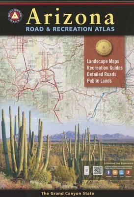
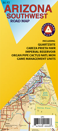
 Scale 1:400,000. Size 11"x16". 112 pages. Indexed. Benchmark Maps edition. The Grand Canyon State abounds in natural beauty and outdoor possibilities. Completely reworked with larger scale Landscape Maps and a comprehensive Recreation Guide, our Arizona Road and Recreation Atlas is an invaluable resource for adventure planning and exploration. Our first ever Arizona Recreation Map is now available to help guide you on your next trip to the southwest.
 - $24.95 + $7.50 p&h or $28.80 foreign delivery
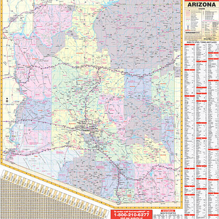
Item Code : KAPA22482
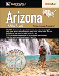
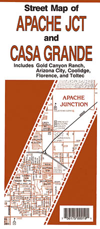
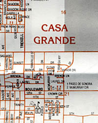
 Size 8½" x 11". Kappa Map Group. The Arizona Travel Atlas is a full-color highway atlas, including street-detail insets of: Apache Junction, Avondale, Casas Adobes, Chandler, Flagstaff, Gilbert, Glendale, Maricopa, Mesa, Oro Valley, Peoria, Phoenix, Prescott, Scottsdale, Sedona, Sierra Vista, Sun City, Surprise, Tempe, Tucson, West Sedona, West Sun City, and Yuma; and features: Airports, detailed Attractions, Golf Courses and Museums, Indian Reservations, a Mileage Chart, National Forests, National Monuments, and State Parks
 - $259.95 + $24.80 p&h
Item Code : RAND4962
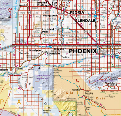
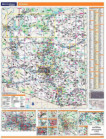 Scale 1:660,000. Size 60" W x 46" H. Laminated. Rand McNally's regional wall map of Arizona is ideal for anyone needing a comprehensive representation of the area for planning, routing, or reference. It's a great choice for business and sales strategy, urban development, social work outreach, education, and marketing. Arizona residents, businesses, and government offices are sure to find this wonderful reference tool irreplaceable. ?The laminated wall map is printed with UV-resistant ink to help prevent color fading. ?Map details include state highways, federal highways, county highways, county boundaries, city shading, cities and towns, major waterways, state/national parks, campsites, exit numbers, rest areas, military installations, airports, golf courses, universities, and much more. ?You'll also find a city/county index on the map, Rand McNally Express Access Codes for more information online, and a driving times map between major cities in the region. ?This truly complete wall map even includes a hanging kit with rails for easy mounting just about anywhere. Inset maps include: Flagstaff; Lake Havasu City; Phoenix & Vicinity; Phoenix downtown; Prescott; Tucson & Vicinity; Tuscon downtown; Yuma; Grand Canyon National Park; and Petrified Forest National Park.
 - $249.95 + $24.80 p&h (add $40 for spring rollers)
Item Code : UNIV4963
 Scale 1:80,000. Size 56" W x 60" H. Laminated. It has the following special features and data: all state highways, major waterways, towns, military installations, all federal highways, major airports, state universities, points of interest, cities, state parks, and wildlife areas. Other features include color coded counties and a mileage chart between major cities. Provides up-to-date cartography at a scale of 1" = 8 miles. Printed in color with a markable and washable, laminated surface. Cities and counties are indexed on the face of the map. Contains hanging rails mounted top and bottom for ease in hanging. Railed wall maps can be turned into pull down maps on spring rollers for an additional $40.
 - $12.95
Item Code : BENC21552
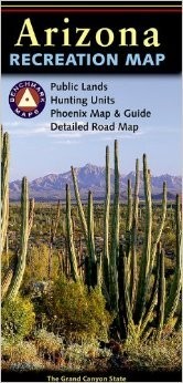
 Benchmark Maps edition. The Arizona Recreation Map is the ideal planning tool for everything outdoors, from rugged backcountry adventure to a nearby day-hike. It's the only New Arizona folded map that benefits from Benchmark's renowned field-checking, proven accuracy, and cartographic excellence. The Arizona Recreation Map features: * Campground Listings * Forest & Wildlife Areas * Parks & Monuments * Comprehensive Index This map was compiled from the Arizona Road & Recreation Atlas; a 108-page book that portrays the entrancing scenery and recreation potential of the entire state.
 - $14.95
Item Code : BENC4967
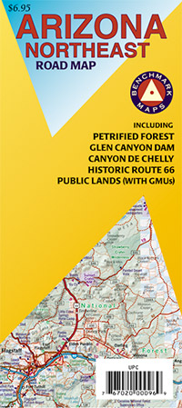
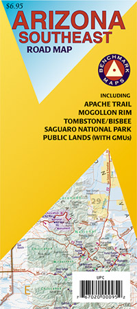
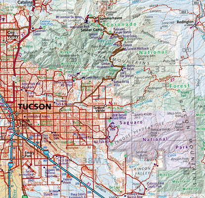
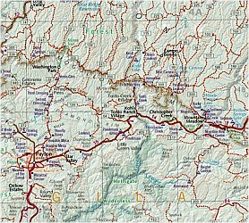 Scale 1:400,000. Size 27"x32". Benchmark Maps edition. This four-sheet set offers complete coverage of Arizona. This series is enhanced by useful lists and notations of campgrounds, parks, reservation areas, parks and wildlife areas, and national monuments are included. Each map includes enlargements of the most popular areas within the sheet area; the Navajo Nation on the Northeast sheet, the Grand Canyon on the Northwest sheet, etc.
 - $12.95
Item Code : BENC4969
 Scale 1:400,000. Size 27"x36". Benchmark Maps edition.
 - $12.95
Item Code : BENC4970
 Scale 1:400,000. Size 27"x32". Benchmark Maps edition.
 - $15.95
Item Code : NATL4971
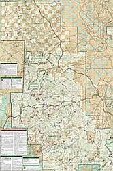
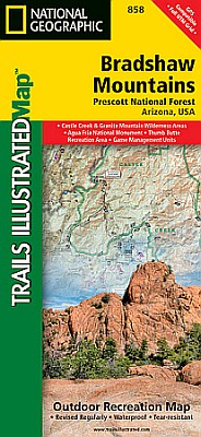 Scale 1:70,000. Size 26"x38". National Geographic edition. One of five new Trails Illustrated maps for Coconino and Prescott National Forests in Arizona offering the most detailed and up-to-date map for the area. Our maps are carefully researched and developed in co-operation with local land managers and agencies. Each map contains easy to read trails, numbered forest service roads, campsites, access points, scenic points-of-interests, and important facilities. Coverage Highlights: Castel Creek & Granite Mountain Wilderness Areas, Agua Fria River, Scenic Byways and Routes, Hiking Trails, Mountain Biking, Campgrounds, Horseback Riding. Wilderness Coverage: Castel Creek, Granite Mountain. Other Attractions: Cellers Basin, Black Canyon, Black Mesa, Sycamore Mesa.
 - $16.95
Item Code : NATL4966
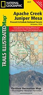
 Scale 1:70,000. Size 26"x38". National Geographic edition. One of five new Trails Illustrated maps for Coconino and Prescott National Forests in Arizona offering the most detailed and up-to-date map for the area. Our maps are carefully researched and developed in co-operation with local land managers and agencies. Each map contains easy to read trails, numbered forest service roads, campsites, access points, scenic points-of-interests, and important facilities. Coverage Highlights: Apache Creek, Granite Mountain, Juniper Mesa and Woodchute Wilderness Areas, Verde River Wild & Scenic River, Scenic Byways and Routes, Hiking Trails, Mountain Biking, Campgrounds, Horseback Riding. Wilderness Coverage: Apache Creek, Granite Mountain, Juniper Mesa, Woodchute. Other Attractions: Chino Valley, Little Chino Valley, Lonesome Valley, Santa Maria Mountains.
 - $10.95
Item Code : NORT4999
 Scale 1:40,000. Size 18"x27". North Star edition.
| Postage and handling is $4.40 for the first map and $1.80 for each additional map. ~ ~ ~ ~ ~ ~ Foreign delivery is $15.80 for the first map and $7.60 for each additional map. ~ ~ ~ ~ ~ ~ Canada delivery is $15.80 for the first map and $7.60 for each additional map. |
| Postage and handling is $4.40 for the first map and $1.80 for each additional map. ~ ~ ~ ~ ~ ~ Foreign delivery is $15.80 for the first map and $7.60 for each additional map. ~ ~ ~ ~ ~ ~ Canada delivery is $15.80 for the first map and $7.60 for each additional map. |
Get to Know about Arizona Through Elaborate and Informative Maps
Arizona is the 6th biggest and the 14th densely populated state in the US. It is situated in the Rocky Mountainous southwestern area of the United States. The whole area of this state is 114,000 sq mi (295,260 sq km), out of which land occupies 113,508 sq mi (293,986 sq km) plus 492 sq mi (1,274 sq km) is of inland water. At times the state of Arizona is referred as America’s Italy.
Arizona is spread over an area of 113,990 square miles. The boundaries of the state are shared with the US states of California, Utah, Nevada, New Mexico and a single common point with Colorado. The borders of the state are shared with Mexico as well. Phoenix, the biggest state of Arizona is the capital as well. Arizona is, in addition, acknowledged as the Grand Canyon State. A few of the well-maintained meteorite impact sites of the world is also found in Arizona.
Tourists spots of Arizona
Grand Canyon which its stunning scenery is one among the most popular tourist spots. The wrecks of 3 early Spanish colonial missions are being conserved at the National Historical Park of Tumacacori. 30 different and varied species of cactus can be found at Organ Pipe Cactus National Monument. There are more places which are worth visiting like Jerome, Havasu Falls, Bisbee, Canyon De Chelly National Monument, Petrified Forest National Park, Saguaro National Park, among others.
Arizona Map
Arizona, a very popular weekend escape spot for those who live in the desert is a place to escape the wrath of the sun during summer from the Phoenix plus Scottsdale region. You can very easily and interestingly know a lot about Arizona with our detailed and instructive map. The Map of Arizona will acquaint you with each and every minute details of Arizona.
Arizona Road Maps for Tourists and TravelersDetailed Road Map of ArizonaBuy travel maps for Arizona tourist attractions, road trips, street guide, driving directions and more |
