
Guadeloupe Road Maps | Detailed, Travel, Tourist, Driving
|
Guadeloupe Road Maps |
Guadeloupe
- $17.95
Item Code : ITMB8922

Scale 1:110,000 / 1:50,000. International Travel Maps edition.
The country of Guadeloupe actually consists of six islands, with the main island being divided by a narrow peninsula into Basse-Terre and Grand-Terre. It is a French possession, so uses the Euro as its currency. The other touristic island is Marie Galante, which one reaches by ferry from the capital city of Pointe-a-Pitre.
The only airport is north of the capital, and touristic access is through it, or via the regular ferry from Dominica. Obviously, the lingua franca is French, and the towns have exotic sounding names like Petites-Anses, Grand-Bourg, or Le Moule. Touristic resorts exist, but are scattered, unlike the complexes in Mexico. The road network is more basic, but reasonably comprehensive, and the significance of the country is that of a Caribbean European enclave combining the best of both continents.
The other side of the map consists of a detailed map of Dominica, a popular cruise ship stop-over. The capital is Roseau, and an inset map is included. Beach resort enclaves exist south of the city, but what Dominica offers that varies from most other Caribbean islands is a well-developed network of inland resorts to explore the jungle-like mountainous parts of the island. Definitely a different travel experience!
- $18.95
Item Code : IGNF18664
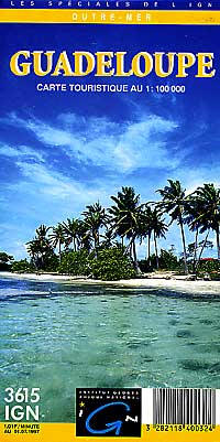
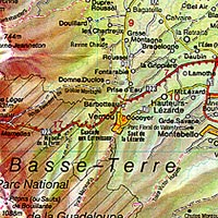
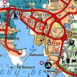 Scale 1:100,000. Size 110x88 cms ( = 35"x43"). Institute Geographique National de France edition. English and French text. This is a beautiful detailed travel map of the island with lots of physical and topographic details and considerable tourist information.
 - $16.95
Item Code : HILD18665
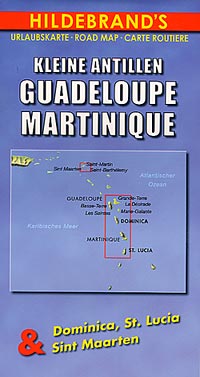
 Various scales. Size 29"x41". Hildebrand edition. English and multilingual legends. Lots of useful travel information. Also includes detailed inset maps of Dominica, St. Lucia, and St. Martin (Sint Maarten).
 - $10.95
Item Code : 18666
Scale 1:25,000. Very detailed. Please see the list below:
|
Guadeloupe Road Maps |
