
Ann Arbor & Washtenaw Wall Map
$249.95
In stock
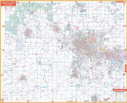
The 2006, 3rd. edition Ann Arbor-Washtenaw County, Michigan Wall Map by Kappa Map Group measures 64” W x 54” H in complete street detail at a scale of 1” = 2,600 feet. Provides up-to-date cartography with new streets and changes. Printed in color with a markable/washable-laminated surface. Streets indexed in a separate book. Mounting rails provided top and bottom for ease in hanging.
Area of coverage: North: To Oakland and Livingston County Line. South: To Lenawee County Line including Milan. East: To Wayne County Line. West: To Jackson County Line.
Details: all streets, all highways, educational facilities, government buildings, shopping centers, hospitals, ZIP codes and boundaries, post offices, fire and police stations, airports, cemeteries, recreational parks, golf and country clubs, points of interest, city limits and annexations, railroads, mileage circles, Water features, block numbers, longitude/latitude lines, school districts, range, township and section lines.
Railed wall maps can be turned into pull down maps on spring rollers for an additional $40.
| Item Price | $249.95 + $24.80 p&h (add $40 for spring rollers) |
|---|
Write Your Own Review