
North Carolina WALL Map, America.
$249.95
In stock
Professional grade lamination. The 4th Edition North Carolina Wall Map by Universal Map measures 67" W x 42" H. (5'7" W x 3'6" H) and provides up-to-date cartography at a large scale of 1" = 8 miles ( = 1:518,400). Printed in color with a markable/washable surface. Cities and counties are indexed on the face of the map. (The correct illustration for the new 4th edition of the North Carolina map is not yet available, so we have substituted the Tennessee map illustration just to give you an idea of how the map will be presented.) Features color coded counties, mileage chart between major cities, and inset maps of Charlotte, Raleigh, Fayetteville, and Winston Salem. Includes the following details: all state highways, all federal highways, cities and towns, major waterways, major airports, state parks, state universities, military installations, points of interest, and mileage chart. Framing rails are included on top and bottom for easy wall mounting. Railed wall maps can be turned into pull down maps on spring rollers for an additional $40.
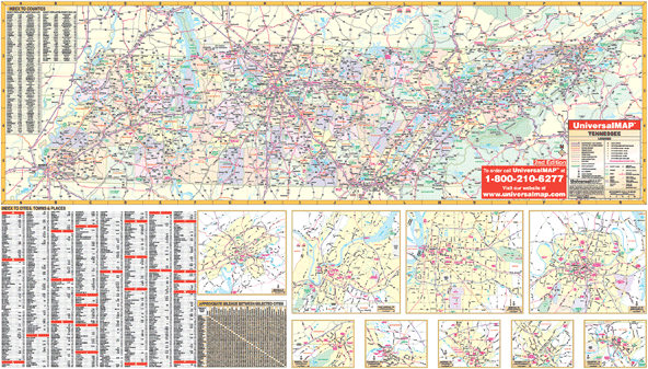
Professional grade lamination. The 4th Edition North Carolina Wall Map by Universal Map measures 67" W x 42" H. (5'7" W x 3'6" H) and provides up-to-date cartography at a large scale of 1" = 8 miles ( = 1:518,400). Printed in color with a markable/washable surface. Cities and counties are indexed on the face of the map. (The correct illustration for the new 4th edition of the North Carolina map is not yet available, so we have substituted the Tennessee map illustration just to give you an idea of how the map will be presented.) Features color coded counties, mileage chart between major cities, and inset maps of Charlotte, Raleigh, Fayetteville, and Winston Salem. Includes the following details: all state highways, all federal highways, cities and towns, major waterways, major airports, state parks, state universities, military installations, points of interest, and mileage chart. Framing rails are included on top and bottom for easy wall mounting. Railed wall maps can be turned into pull down maps on spring rollers for an additional $40.
| Item Price | $249.95 + $24.80 p&h (add $40 for spring rollers) |
|---|
Write Your Own Review