
North Dakota Road Maps | Detailed Travel Tourist Driving
|
North Dakota Road Maps |
North Dakota
- $10.95
Item Code : UNIV11888

 Scale 1:1,100,000. Size 37"x24". Universal Maps edition. Indexed.
 - $11.95
Item Code : RAND11889
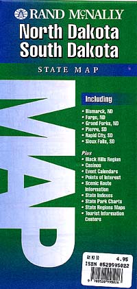
 Scale 1:1,250,000. Size 37"x26". Rand McNally edition.
 - $27.95 + $7.50 p&h or $28.50 foreign delivery
Item Code : DELR11892

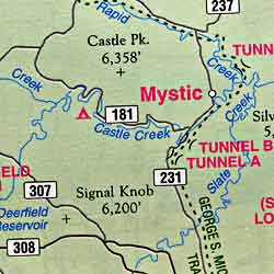
 Scale 1:203,000. Full size, 11"x15?". 64 pages. Designed for those who want to get off the beaten path, this atlas shows all types of roads and tracks, cities, towns, hamlets, and provides topographic maps that show hiking trails, campgrounds, fishing spots, ski areas, and more. Contains a guide to state and national parks and recreation areas, historic sites, and unique natural areas. Comprehensive index enables the user to find locations quickly and easily. Great for car or backpack! Saddle-stitched, durable laminated paper cover.
 - $259.95 + $24.80 p&h
Item Code : RAND11893
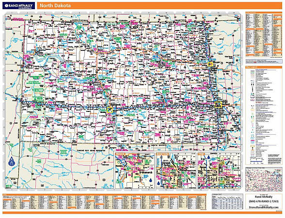 Scale 1:850,000. Size 60" W x 46" H. Laminated. Rand McNally's regional wall map of North Dakota is ideal for anyone needing a comprehensive representation of the area for planning, routing, or reference. It's a great choice for business and sales strategy, urban development, social work outreach, education, and marketing. North Dakota residents, businesses, and government offices are sure to find this wonderful reference tool irreplaceable. ?The laminated wall map is printed with UV-resistant ink to help prevent color fading. ?Map details include state highways, federal highways, county highways, county boundaries, city shading, cities and towns, major waterways, state/national parks, campsites, exit numbers, rest areas, military installations, airports, golf courses, universities, and much more. ?You'll also find a city/county index on the map, Rand McNally Express Access Codes for more information online, and a driving times map between major cities in the region. ?This truly complete wall map even includes a hanging kit with rails for easy mounting just about anywhere. Inset maps include: Bismarck, Grand Forks, and Fargo.
 - $249.95 + $24.80 p&h (add $40 for spring rollers)
Item Code : UNIV11894
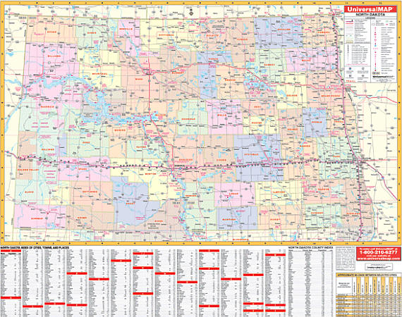 Scale 1:660,000. Size 63" W x 51" H. Laminated. Printed in color with a markable/washable-laminated surface. Cities and counties are indexed on the face of the map. Mounted top and bottom on hanging rails for ease in mounting. Special features include color-coded counties with county seat and populations and a mileage chart between major cities. Details all state and federal highways, secondary roads, cities and towns, major airports, major waterways, state universities, military installations, state and national parks, exit numbers, longitude/latitude lines, and various points of interest. Railed wall maps can be turned into pull down maps on spring rollers for an additional $40.
 -
-
-
- $17.95
Item Code : TRAL11895
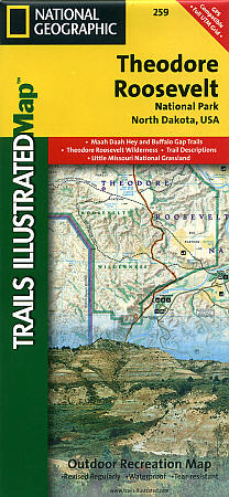
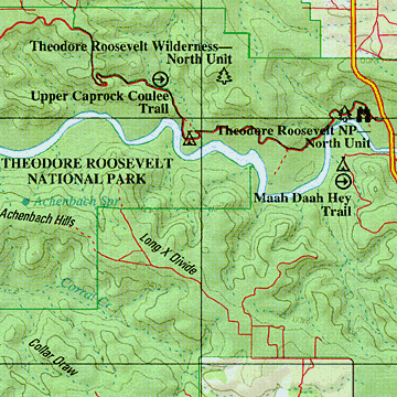
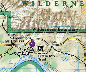 Scale 1:40,000. Size 25"x37". Trails Illustrated edition. Printed on waterproof, tear-resistant, lightweight, paper-like plastic. This Trails Illustrated topographic map is the most comprehensive recreational map for North Dakota's Theodore Roosevelt National Park and the 96-mile Maah Daah Hey Trail. This two-sided map includes both the north and south units of Theodore Roosevelt National Park, as well as the Magpie and Elkhorn section of the Little Missouri Grassland. In the North Unit of the park, the map includes the Maah Daah Hey Trail, Little Mo Nature Trail, Caprock Coulee Nature Trail, Juniper camping area, and more. The Maah Daah Hey Trail winds south through the Little Missouri National Grassland, meeting Bennett Trail, passes into Magpie, then Elkhorn, then into the South Unit of Theodore Roosevelt National Park. Map features in the South Unit include Ridgeline Nature Trail, Wind Canyon Trail, the Petrified Forest, Buffalo Gap Trail, Roundup Horse Camp, Cottonwood, Painted Canyon, Sully Creek State Park, the town of Medora, and much more. Includes UTM tick marks for use with your GPS unit.
|
North Dakota Road Maps |
My Wish List
Last Added Items
You have no items in your wish list.
