
Quebec Road Maps | Detailed Travel Tourist Driving
|
Quebec Road Maps |
Quebec Road Maps
-
- $17.95
Item Code : ITMB12801
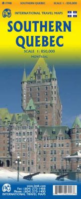 Scale 1:850,000. International Travel Maps edition. La Belle Province has a lot in common with Ontario. It is a huge political entity, with most of the land mass unusable due to permafrost. Almost all the roads and settlements are in the southern part of the province, so we expanded the scale of our artwork and created a map that will be of greater practical use for visitors than one of the entire province. Even so, the distances are formidable (say it in French; it sounds much more dramatic!) Side one concentrates on the region north of Montreal, and includes the Canadian Shield region of Abitibi. The second side follows the St.Lawrence River eastward to Quebec city, where one can continue eastward on the north shore for hundreds of kilometers or cross over an enormous bridge to the south shore and do essentially the same; ending up in the picturesque Gaspe Peninsula! This is an easy to use map, with good details and a lot of information as to camping sites, interesting points of view, access points from the USA, and roads leading far into the interior. It also includes an excellent inset map of central Montreal.
 - $49.95 Rolled + 16.80 p&h or $66.80 foreign delivery
Item Code : ITMB4235
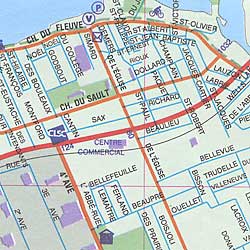
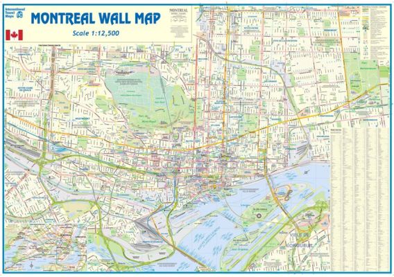 Scale 1:12,500. International Travel Maps edition.
 - $14.95
Item Code : GMJO8793

 Scale 1:800,000. Size 27"x39". G.M. Johnson edition. This Map Coverage Area are Chicoutimi-Jonquiere, Gatineau, Eastern Quebec, Iles-De-La-Madeleine, Lower North Shore, Montreal, Montreal et Environs, Quebec, Rimouski, Sherbrooke, Trois-Rivieres, Ville De Quebec, Western Quebec, Distance Chart.
 - $14.95
Item Code : GMJO7828
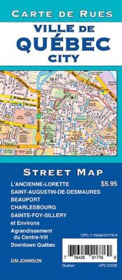 Scale 1:25,000. Size 27"x39". G.M. Johnson edition. This Map Coverage Area are Beauport, Charlesbourg, L’Ancienne-Lorette, La Cite, La Haute-Saint-Charles, Lac-Beauport, Lac-Delage, Laurentien, Les Rivières, Lévis, Limoilou, Quebec, Saint-Augustin-Dedesmaures, Sainte-Foy-Sillery, Stoneham Et Tewkesbury, Centre-Ville, Downtown Quebec.
 - $12.95
Item Code : MART21357
Scale 1:800,000. MapArt. - $17.95
Item Code : ITMB12769

Scale 1:1,620,000/1:150,000. Size 27"x39". International Travel Maps edition.
The largest geographical province of Canada is Quebec. While much of it is inaccessible landmass, the province is home to millions of people, both French and English, and is a major North American attraction.
It contains the only walled city in the continent (Quebec City, the capital), a major ski resort (the Laurentians), and the vibrant city of Mont Real (Montreal).The map is double-sided, with the vast expanse of northern Quebec on one side (count the number of lakes!) and the more populous south on the other side.
Due to the size of the province, there was only room left over for a regional map of the Montreal area, but ITMB does publish a separate map of that city for those needing more detail. As a point of trivia, the northernmost tipoff the Labrador Peninsula is part Nunavut, as are all of the islands.
- $26.95 + $6.80 p&h or $18.80 foreign delivery
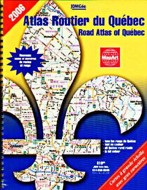
Item Code : MART21342
Various Scales. Size 8"x11". MapArt edition. The Quebec Road Atlas allows you to see all the names and numbers of the Provinces backroads and Highways. Ideal for the weekend Cottager business person on the go. - $29.95 + $6.80 p&h or $14.80 foreign delivery
Item Code : MART12770
 MapArt Quebec Province Road Atlas, Canada. Travel, tourist, detailed, driving, street. Various Scales. Size 8?"x11". 134 pages. Indexed. English and French legends and text.
 - $36.95 + $6.80 p&h or $18.80 foreign delivery
Item Code : MSIO12771
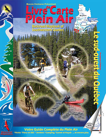
 Size 8?"x11". 112 pages. Mussio Ventures Ltd edition. Welcome to the premier edition of Backroad Mapbooks for Quebec’s Outaouais region. Already a big success in BC, Alberta, and Ontario, Backroad Mapbooks is pleased to present their first Quebec publication. Dedicated to providing the most complete and detailed information needed for outdoor adventure, it would be unthinkable for us to not write about a province with such extensive recreation opportunities. Inside this guidebook, you will find the most comprehensive outdoor recreation resource available for the Outaouais region. With its diverse landscape, the Outaouais is a favorite destination choice amongst outdoor enthusiasts. Located in Quebec’s southwest, the Outaouais is bordered by Abitibi-Temiscamingue, the Laurentians, and Canada’s capital city, Ottawa. With a multitude of colorful mountains, rolling hills, deep forests, tame and wild rivers, and over 20,000 lakes, the opportunities for outdoor adventures are endless. Whether you want to hike or ski the many trails in the renowned Gatineau Park, take a week off to explore the lakes and rivers of the La Verendrye Wildlife Reserve on a canoe-camping trip, try your hand at fishing at some of Temiscamingue’s hot spots, or take a leisurely bike-ride through the old-fashioned and inviting towns that populate the Gatineau Valley, the Outaouais offers it all.
 - $36.95 + $6.80 p&h or $18.80 foreign delivery
Item Code : MSIO12772
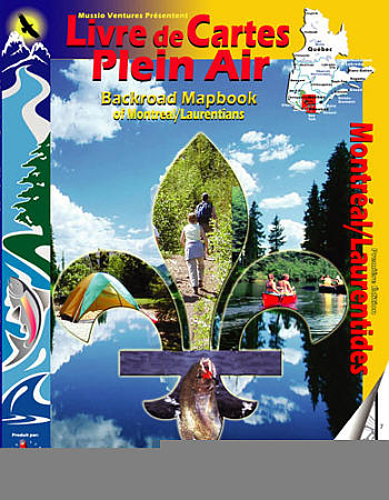
 Size 8?"x11". 128 pages. Mussio Ventures Ltd edition. Welcome to the premier edition of Backroad Mapbooks for the Montreal/Laurentians area. The Laurentians tourist area upholds an international reputation as being an excellent outdoor recreation destination. This mountainous region offers a selection of some of Québec’s finest summits. Whether you travel on foot, bike, skis or snowmobile, the many trails that explore these hills will be sure to fascinate you. Similarly, the countless lakes and rivers that wind around the mountains present fishermen and paddlers with an unlimited choice of waterways to explore. The Laurentians are especially well known as a ski destination and offers outdoor enthusiasts with a vast territory where they can practice winter recreation activities. The metropolitan city of Montreal also offers its share of parks and trail networks. As an island, there are many nice areas that border the city where you can go for a walk or bike-ride near the Saint-Lawrence River or take a canoe trip across to neighbouring islands.
 - $10.95
Item Code : CTEK12773
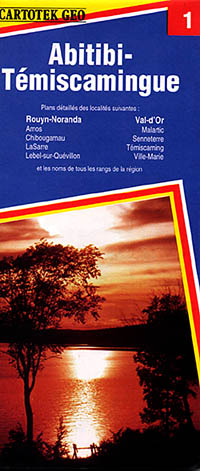
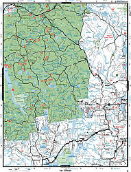
 Scale 1:400,000. Size 27"x40". Cartotech edition. English and French text and legends.
 - $10.95
Item Code : CTEK12774
Scale 1:175,000. Size 27"x40". Cartotech edition. English and French text and legends. - $10.95
Item Code : CTEK12775
Scale 1:175,000. Size 27"x40". Cartotech edition. English and French text and legends. - $10.95
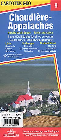
Item Code : CTEK12776
Scale 1:175,000. Size 27"x40". Cartotech edition. English and French text and legends. Includes a detailed city street plan of Montreal on the reverse side. - $10.95
Item Code : CTEK12777

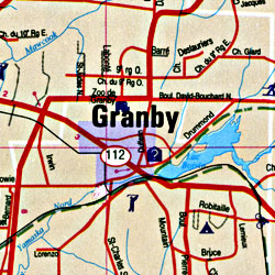 Scale 1:175,000. Size 27"x40". Cartotech edition. English and French text and legends. .
 - $10.95
Item Code : CTEK12778
Scale 1:175,000. Size 27"x40". Cartotech edition. English and French text and legends. - $10.95
Item Code : CTEK12779
Scale 1:175,000. Size 27"x40". Cartotech edition. English and French text and legends. - $10.95
Item Code : CTEK12780
Scale 1:175,000. Size 27"x40". Cartotech edition. English and French text and legends. - $10.95
Item Code : CTEK12781
 Scale 1:175,000. Size 27"x40". Cartotech edition. English and French text and legends.
|
Quebec Road Maps |
