
Vermont Road Maps | Detailed Travel Tourist Driving
|
Vermont Road Maps |
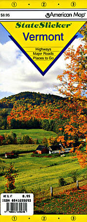
Vermont
- $10.95
Item Code : UNIV14293

 "Various Scales". Size 18"x24". Universal Map edition.
 - $12.95
Item Code : AMER14294
 Scale 1:470,000. Size 21"x25". American Map Company edition. Laminated.
 - $12.95
Item Code : AMER14295
 Scale 1:690,000. Size 21"x25". American Map Company edition. Laminated.
 - $10.95
Item Code : AMER14301
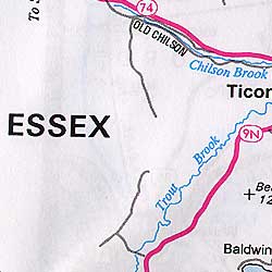
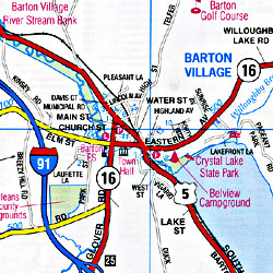
 Scale 1:70,000. Size 26"x40". American Map Company edition.
 - $10.95
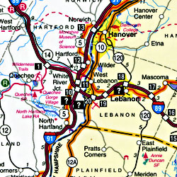
Item Code : AMER14302
 Scale 1:120,000. Size 26"x40". American Map Company edition.
 - $16.95
Item Code : NATL14296
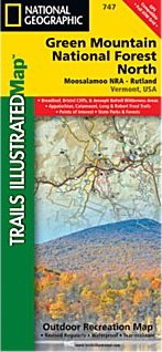
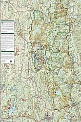 Scale 1:70,000. Size 26"x38". National Geographic edition. Two Trails Illustrated maps for Green Mountain National Forest (747 and 748) offer the most detailed and up-to-date map for the area. Each map contains easy to read trails, numbered forest service roads, campsites, access points, scenic and historic points-of-interests, and important facilities. Our carefully researched maps are developed in cooperation with local land managers and agencies. Green Mountain National Forest covers more than 400,000 acres that stretch across nearly two-thirds the length of Vermont. Coverage Highlights: Breadloaf, Bristol Cliffs & Joseph Battell Wilderness Areas, Big Branch, George Aiken, Glastenbury, Lye Brook & Peru Peak Wilderness Areas, Long Trail National Recreation Trail, Robert Frost Interpretive Trail, Connecticut River Byway, Moosalamoo National Recreation Area, Middlebury Gap Scenic Route, state parks, ski areas, heritage sites, winter recreation and sports areas, hiking trails, mountain biking, campgrounds, fishing, cross-country skiing and support centers, overlap with Trails Illustrated White Mountains coverage, and much more.
 - $16.95
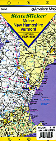
Item Code : NATL14297
Scale 1:70,000. Size 26"x38". National Geographic edition. - $259.95 + $24.80 p&h
Item Code : RAND14299
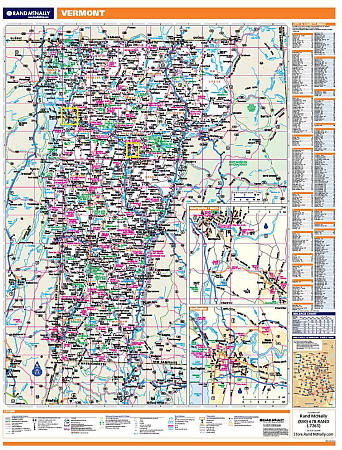
 Scale 1:370,000. Size 60" W x 46" H. Laminated. Rand McNally's regional wall map of Vermont is ideal for anyone needing a comprehensive representation of the area for planning, routing, or reference. It's a great choice for business and sales strategy, urban development, social work outreach, education, and marketing. Vermont residents, businesses, and government offices are sure to find this wonderful reference tool irreplaceable. ?Laminated wall map is printed with UV-resistant ink to help prevent color fading ?Map details include state highways, federal highways, county highways, county boundaries, city shading, cities and towns, major waterways, state/national parks, campsites, exit numbers, rest areas, military installations, airports, golf courses, universities, and much more ?City/county index on the map ?Mileage chart with 64 mileage pairs between 16 cities ?Includes a hanging kit with rails for easy mounting just about anywhere. Inset maps include: Burlington and Montpelier/Barre.
 - $229.95 + $24.80 p&h (add $40 for spring rollers)
Item Code : UNIV14300
 Laminated. Universal Map Wall Maps provide up-to-date cartography showing new streets and changes. Plotted in complete street detail. Printed in color with a markable/washable-laminated surface. Provides street indexing on the face of the map or in a separate book. Framing rails are included on top and bottom for easy wall mounting. Railed wall maps can be turned into pull down maps on spring rollers for an additional $40.
 - $10.95
Item Code : AMER14305
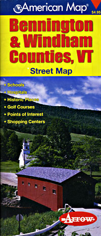
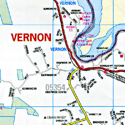 Scale 1:70,000. Size 26"x40". American Map Company edition.
 - $10.95
Item Code : UNIV14306

 Scale 1:33,000. Size 22"x34". Universal Map edition.
 -
- $12.95
Item Code : MART21390
MapArt edition. Detailed city street map. - $16.95
Item Code : NATL20954
 Scale 1:70,000. Size 26"x38". National Geographic edition. National Geographic's Trails Illustrated map of Mount Mansfield / Stowe is a two-sided, waterproof map designed to meet the needs of outdoor enthusiasts with unmatched durability and detail. This map was created in conjunction with local land management agencies and is loaded with valuable recreation information. Trails Illustrated maps are expertly researched and frequently updated, and printed in the United States on durable synthetic paper, making them waterproof, tear-resistant, and trail tough—capable of going anywhere you do. Loaded with valuable safety tips, guidelines for outdoor recreation, park contact information and more, the map also includes a UTM and Latitude/Longitude grid, as well as selected waypoints and a scale bar for easy and accurate navigation. Features clearly marked trails for hiking, biking, horseback riding, and more; detailed topography and clearly defined, color-coded boundaries of state parks, national recreation areas, wilderness areas, marine sanctuaries, and wildlife refuges; hundreds of points-of-interest, including scenic viewpoints, campgrounds, boat launches and canoe carry downs, swimming areas, fishing access points, and more.
 - $10.95
Item Code : AMER14313
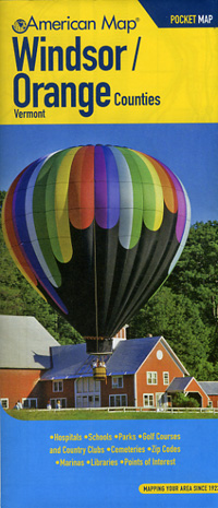
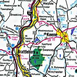
 Scale 1:27,000. Size 26"x40". American Map Company edition.
|
Vermont Road Maps |
