
Owensboro WALL Map.
$249.95
In stock
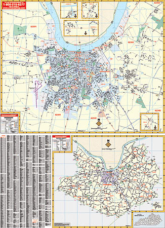
Size 54" W x 70" H. Laminated. Printed in color with a markable/washable--laminated surface. Streets indexed in a separate book. Framing rails are included on top and bottom for easy wall mounting. Railed wall maps can be turned into pull down maps on spring rollers for an additional $40. Area of coverage: All of Cherokee County with the following boundaries: North: Pickens & Cherokee County line; South: Cobb, Fulton, Cherokee County lines; East: Forsyth & Cherokee County lines; West: Bartow & Cherokee County lines. Details include all streets and highways, government buildings, airports, water features, fire/police stations, hospitals, educational facilities, shopping centers, railroads, ZIP codes/boundaries, golf and country clubs, post offices, cemeteries, city limits & annexations, and points of interest.
Size 54" W x 70" H. Laminated. Printed in color with a markable/washable--laminated surface. Streets indexed in a separate book. Framing rails are included on top and bottom for easy wall mounting. Railed wall maps can be turned into pull down maps on spring rollers for an additional $40. Area of coverage: All of Cherokee County with the following boundaries: North: Pickens & Cherokee County line; South: Cobb, Fulton, Cherokee County lines; East: Forsyth & Cherokee County lines; West: Bartow & Cherokee County lines. Details include all streets and highways, government buildings, airports, water features, fire/police stations, hospitals, educational facilities, shopping centers, railroads, ZIP codes/boundaries, golf and country clubs, post offices, cemeteries, city limits & annexations, and points of interest.
| Item Price | $249.95 + $24.80 p&h (add $40 for spring rollers) |
|---|
Write Your Own Review