
Phoenix Vicinity WALL Map, Arizona, America.
$229.95
In stock
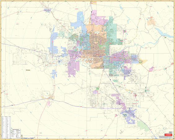
Scale 1:210,000. Size 54" W x 66" H. Laminated. Printed in color with a markable and washable laminated surface. Cities are indexed on the face of the map. Hanging rails mounted top and bottom for your convenience. Railed wall maps can be turned into pull down maps on spring rollers for an additional $40. The area of coverage includea all of Maricopa County and approximately 70% of Pinal County with the following boundaries: North: to the Maricopa County line; South: to the Pinal County line; East: includes Superior City; West: to the Maricopa County line. Details include major streets and all highways, water features, zip codes and boundaries, county lines, airports, mileage circles, parks, and other points of interest.
Scale 1:210,000. Size 54" W x 66" H. Laminated. Printed in color with a markable and washable laminated surface. Cities are indexed on the face of the map. Hanging rails mounted top and bottom for your convenience. Railed wall maps can be turned into pull down maps on spring rollers for an additional $40. The area of coverage includea all of Maricopa County and approximately 70% of Pinal County with the following boundaries: North: to the Maricopa County line; South: to the Pinal County line; East: includes Superior City; West: to the Maricopa County line. Details include major streets and all highways, water features, zip codes and boundaries, county lines, airports, mileage circles, parks, and other points of interest.
| Item Price | $229.95 + $24.80 p&h (add $40 for spring rollers) |
|---|
Write Your Own Review