
$259.95
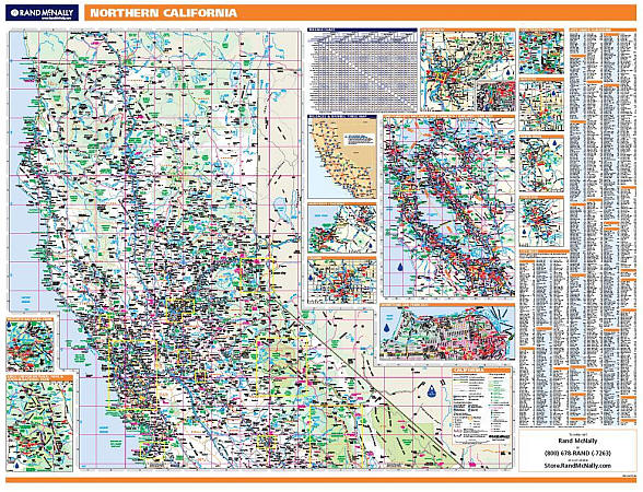
Scale 1:104,000. Size 60" W x 46" H. Laminated. Rand McNally's ProSeries wall map of Northern California is ideal for anyone needing a comprehensive representation of the state for planning, routing, or reference. It's a great choice for business and sales strategy, urban development, social work outreach, education, and marketing. Map features: ?Durable lamination for writing on and wiping off ?UV-resistant ink to help prevent color fading ?City/county index on the map ?Inset maps of major cities (see below) ?Mileage chart and driving times map between the state's main cities ?Hanging kit with rails for easy mounting just about anywhere ?Ideal for business, education, planning, or reference planning. Map indications include: ?State, federal, and county highways ?County boundaries ?Cities and towns ?Major waterways ?State and national parks ?Campsites ?Rest areas ?Military installations ?Airports ?Golf courses ?Universities ?Coverage area: Northern California. ?Inset maps: Fresno, Modesto, Monterey, Sacramento, Sacramento downtown, San Francisco, San Francisco downtown, Santa Rosa, Stockton, Sequoia & Kings Canyon National Park, and Yosemite National Park.
Write Your Own Review