
$249.95
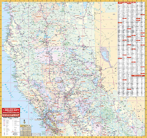
Scale 1:660,000. Size 54" W x 54" H. Laminated. Northern California Wall Map by Universal Map covers approximately 47 counties. Uses up-to-date cartography, is printed in color, laminated, indexed on the map's face for cities/counties, and shows color-coded counties. Coverage ranges north to the state line; south to include San Jose; east to the Nevada state line including Reno; and west to the Pacific Ocean. Details all state highways, state universities, cities, towns, points of interest, longitude/latitude lines, all federal highways, military installations, state/national parks, mileage charts, county names/boundaries, major waterways, major airports, wildlife areas, and mileage circles. Framing rails are included on top and bottom for easy wall mounting. Railed wall maps can be turned into pull down maps on spring rollers for an additional $40.
Write Your Own Review