
$249.95
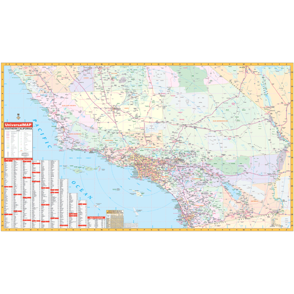
Scale 1:660,000. Size 59" W x 36" H. Laminated. Provides a laminated surface that is both markable and washable. Cities and the color-coded counties are indexed on the face of the map. The area of coverage includes all of the following nine counties: Imperial, Kern, Los Angeles, Orange, Riverside, San Bernardino, San Diego, San Luis Obispo, Santa Barbara, and Ventura. Details include all state and federal highways, major waterways, state universities, military installations, major airports, cities and towns, state/national parks, wildlife areas, mileage charts, mileage circles, county names and boundaries, longitude/latitude lines, exit numbers, and points of interest. Framing rails are included on top and bottom for easy wall mounting. Railed wall maps can be turned into pull down maps on spring rollers for an additional $40.
Write Your Own Review