
$249.95
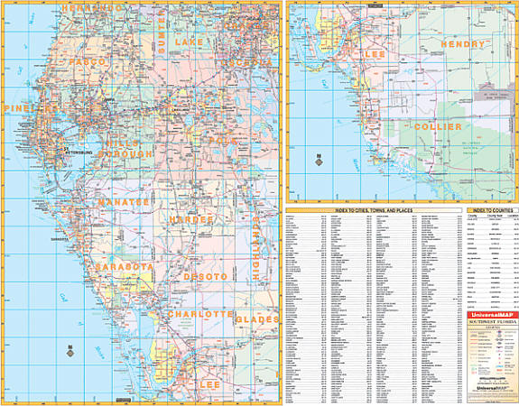
Scale 1:30,080. Size 66" W x 53" H. Laminated. The 2nd edition Wall Map of the Southwestern Florida Region was published by Universal Map. Printed in color with a markable and washable laminated surface. Cities and towns are indexed on the face of the map. Includes hanging rails on top and bottom. Covers all of the following counties: Pasco, Pinellas, Hillsborough, Polk, Manatee, Hardee, Sarasota, De Soto, Charlotte, Lee, and Collier; Boundaries: North: to Brooksville in Hernando Co; South: to Marco Island, Collier Co; East: to Orlando in Orange Co., St. Cloud in Osceola Co., Sebring in Highlands Co., and La Belle in Hendry Co; West: to the Gulf of Mexico. Details include federal and state highways, mileage circles, longitude/latitude lines, New/old interstate exit numbers, ZIP codes, and ZIP code boundaries. Railed wall maps can be turned into pull down maps on spring rollers for an additional $40.
Write Your Own Review