
$249.95
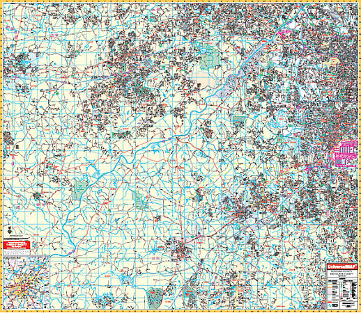
Scale 1:2,640. Size 60" W x 54" H. Laminated. Provides up-to-date cartography with new streets and changes. Printed in color with a markable and washable--laminated surface. Streets are indexed in a separate book. Area of coverage: All of Douglas County and SW Fulton Counties with the following boundaries: North: Cobb County line including the town of Lithia Springs; South: Coweta County line including portions of Tyrone in Fayette County; East: Hartsfield-Jackson Atlanta International Airport, including College Park and East Point in Fulton County; West: Carroll County line including Villa Rica. Map details: all streets and highways, water features, shopping centers, recreational parks, township/section/range lines, government buildings, fire/police stations, educational facilities, golf/country clubs, city limits & annexations, ZIP codes/boundaries, airports, hospitals, railroads, post offices, cemeteries, mileage circles, longitude & latitude lines, block numbers, and points of interest. Comes standard with hanging rails mounted top and bottom. Railed wall maps can be turned into pull down maps on spring rollers for an additional $40.
Write Your Own Review