
$249.95
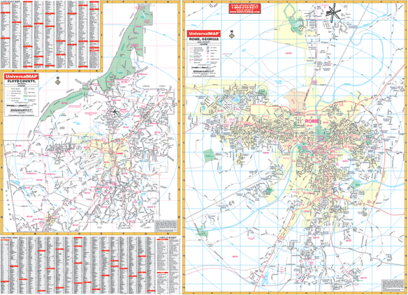
Size 66" W x 49" H. Laminated. The Rome/Floyd County, Georgia Wall Map by Universal Map provides up-to-date cartography plotted in complete street detail with new streets and changes. This map was printed in color and laminated making it markable and washable. The streets have been indexed on the face of the map. The map covers all of Floyd County with the following boundaries: North-to include Richard B. Russell Airport; South-to include Paris Lake and the proposed new sourthern by-pass; East-to Woodcliff Estates; and West-to Woods Road. There is an inset map of Floyd County. The special features and data contained on this map are as follows: all streets and highways, government buildings, airports, golf courses and country clubs, railroads, ZIP codes and ZIP code boundaries, shopping centers, water features, recreational parks, cemeteries, educational facilities, hospitals, post offices, city limits and annexations, fire and police stations, and miscellaneous points of interest. Framing rails are included on top and bottom for easy wall mounting. Railed wall maps can be turned into pull down maps on spring rollers for an additional $40.
Write Your Own Review