
$249.95
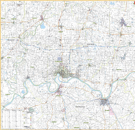
Scale 1:142,000. Size 64" W x 54" H. Laminated. This is a 1st edition Wall Map by Universal Map of Evansville, Indiana and Vicinity. Includes Evansville, Indiana and Henderson and Owensboro, Kentucky with portions of the surrounding 10 counties. Printed in color with a markable and washable laminated surface. Provided with hanging rails mounted top and bottom. Cities are indexed on the face of the map. Area of coverage: In Indiana-includes counties of Dubois, Gibson, Pike, Posey, Spencer, Vanderburg, Warrick; and portions of Wabash, Edwards, and White Counties. In Kentucky-includes Daviess, Henderson, and Hancock Counties; and portions of Ohio, Breckinridge, McLean, and Webster Counties with the following boundaries: North: 40 miles north of Evansville to Petersburg, Hazleton, and West Salem; South: 35 miles South of Evansville to include Calhoun, KY; East: 55 miles east of Evansville to include Cloverport and Hawesville, KY; West: 35 miles west of Evansville to include Carmi in White County. Details major streets and all highways, county lines and names, mileage circles, ZIP code numbers/boundaries, airports and parks, water features, and longitude/latitude lines. Railed wall maps can be turned into pull down maps on spring rollers for an additional $40.
Write Your Own Review