
$249.95
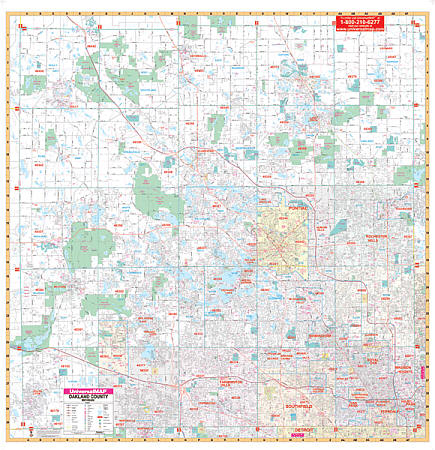
Scale 1:2,800. Size 60" W x 62" H. Laminated. Printed in color and laminated making it markable and washable. Street indexing appears in a separate book. Measures 60" W x 62" H. Area of coverage: North: to the LaPeer County line; South: to the Wayne County line; East: to the Macomb County line; West: to the Livingston County line. Details include all streets and highways, post offices, hospitals, water features, recreational parks, mileage circles, city limits and annexations, cemeteries, shopping centers, block numbers, golf courses and country clubs, ZIP codes and zip code boundaries, airports and railroads, government buildings, fire and police stations, educational facilities, longitude and latitude lines, section/township/range lines, and other points of interest. Special feature: Grid to Range, Township and Section lines are compatible with existing realtor grids, including realtor area numbers. Framing rails are included on top and bottom for easy wall mounting. Railed wall maps can be turned into pull down maps on spring rollers for an additional $40.
Write Your Own Review