
$229.95
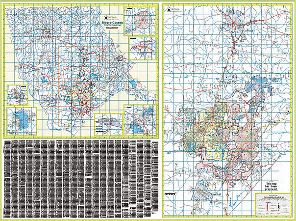
Size 64" W x 46" H. Laminated. The 2nd edition Southern Pines, Moore County, North Caroliina Wall Map by Quality Maps using up-to-date cartography showing new streets and changes, plotted in complete street detail. Printed in color with a markable/washable--laminated surface. Framing rails are included on top and bottom for easy wall mounting. Railed wall maps can be turned into pull down maps on spring rollers for an additional $40. Area of coverage: All of Moore County including: Pinehurst, Aberdeen, Pinebluff, Whispering Pines and Southern Pines. Insets: Cameron, Vass, Foxfire Village, Robbins, Seven Lakes, and Woodlake. Details include all streets and highways, government buildings, airports, water features, fire/police stations, hospitals, shopping centers, educational facilities, railroads, post offices, cemeteries, ZIP codes, and points of interest.
Write Your Own Review