
$249.95
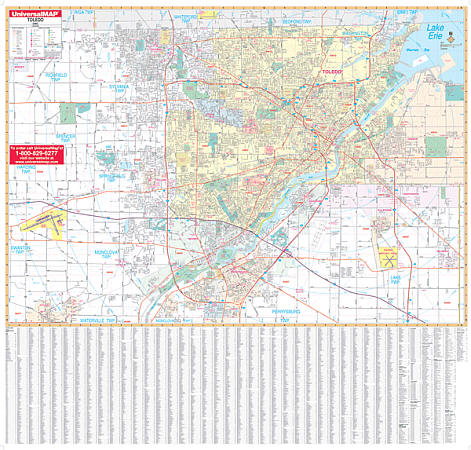
Size 62" W x 54" H. Laminated. The Toledo, Ohio Wall Map by Universal Map includes approximately 375 new streets and changes, shows complete street detail with boundaries north to the Michigan state line; south to Perrysburg; east to Oregon and Millbury; and west to the Toledo Express Airports. Details all streets/highways, government buildings, airports, golf courses/country clubs, railroads, longitude/latitude lines, ZIP codes/boundaries, shopping centers, recreational parks, mileage circles, cemeteries, educational facilities, hospitals, post offices, city limits/annexations, fire/police stations, and more. Measures 62 by 54 inches, is lithographed in 8 colors, laminated, and indexed on the face of the map. Framing rails are included on top and bottom for easy wall mounting. Railed wall maps can be turned into pull down maps on spring rollers for an additional $40.
Write Your Own Review