
$249.95
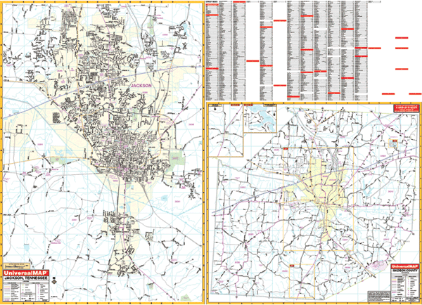
Scale 1:1,760. Size 64" W x 46" H. Laminated. This Jackson, Tennessee Wall Map by Universal Map. The special features and data are as follows: all streets and highways, government buildings, airports, golf courses and country clubs, railroads, longitude and latitude lines, ZIP codes and ZIP code boundaries, shopping centers, recreational parks, mileage circles, cemeteries, educational facilities, hospitals, post offices, city limits and annexations, fire and police stations, and miscellaneous points of interest. North: to the Jackson city limit and Ashport Rd.; South: to Mt. Pinson and Gobelett Rd.; East: to Rose Hill and East Union; West: to the Western Jackson city limit: Section two (Scale of 1" = 4,969 feet) includes Madison County and an inset of Medon and Springport. Framing rails are included on top and bottom for easy wall mounting. Railed wall maps can be turned into pull down maps on spring rollers for an additional $40.
Write Your Own Review