
$249.95
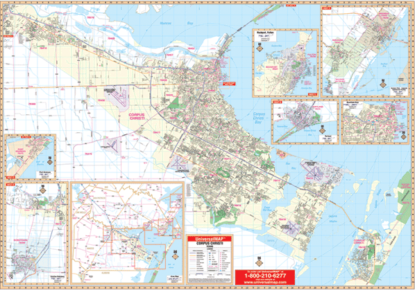
Scale 1:2,480. Size 65" W x 50" H. Laminated. This Wall Map for Corpus Christi, Texas by Universal Map was printed in color on a laminated surface. Durable lamination allows the map to be marked on and washed off. Includes all of Corpus Christi and includes Calallen, Robstown, Portland, Port Aransas, Ingleside, and Aransas Pass. Boundaries are as follows: North: to include Nueces Bay; South: to the Kleberg-Nueces County line; East: to include Mustang Island State Park; West: to include the cities of Calallen and Robstown. Insets are as follows: Portland, Port Aransas, Ingleside, Aransas Pass, and Downtown Corpus Christi. The special features and data contain: all streets and highways, government buildings, airports, golf courses and country clubs, railroads, ZIP codes and ZIP code boundaries, shopping centers, water features, recreational parks, cemeteries, educational facilities, hospitals, post offices, city limits and annexations, longitude and latitude lines, fire and police stations, and miscellaneous points of interest. Framing rails are included on top and bottom for easy wall mounting. Railed wall maps can be turned into pull down maps on spring rollers for an additional $40.
Write Your Own Review