
$249.95
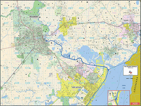
Size 77" W x 54" H. Laminated. The Golden Triangle, Texas Wall Map published by Universal Map. Includes the cities and towns of Beaumont, Bridge City, Groves, Nederland, Orange, Pinehurst, Port Neches, Rose City, Port Arthur, Vidor and West Orange. This map has added approximately 500 new streets and changes. This commercial wall map will show all of Golden Triangle, TX in complete street detail with the boundaries as follows: North: Includes city of Pine Forest. South: Includes city of Port Arthur. East: Includes city Orange. West: Includes city of Beaumont. The special features and data contained on this map are as follows: all streets, all highways, educational facilities, government buildings, shopping centers, hospitals airports, recreational parks, post offices, golf and country clubs, points of interest, city limits and annexations railroads, mileage circles, water features, Longitude and Latitude lines, Cemeteries, Fire and Police Stations, ZIP Code and Boundaries. In addition, for your convenience, the map is indexed on the face of the map. The map is printed on #80 stock material and is protected with a laminate finish, which is both markable and washable. Framing rails are included on top and bottom for easy wall mounting. Railed wall maps can be turned into pull down maps on spring rollers for an additional $40.
Write Your Own Review