
$249.95
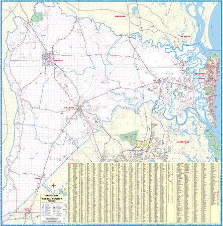
Scale 1:2,560. Size 60" W x 60" H. Laminated. Printed in color with a markable/washable--laminated surface. Street indexed on the face of the map. Framing rails are included on top and bottom for easy wall mounting. Railed wall maps can be turned into pull down maps on spring rollers for an additional $40. Area of coverage: North: to the Georgia State line.; South: to the Duval County line; East: to the Atlantic Ocean.; West: to Georgia and the Baker Couny line. Includes the following areas: Amelia Island, Boulogne, Bryceville, Callahan, Fernandina Beach, Hilliard, Hedges, Kent, Kings Ferry, Nassauville, Ratliff, and Yulee. Details include all streets and highways, government buildings, airports, water features, fire/police stations, hospitals, shopping centers, educational facilities, railroads, recreational parks, golf/country clubs, post offices, city limits/annexations, section/township/range lines, cemeteries, ZIP codes/boundaries, and points of interest.
Write Your Own Review