
$12.95
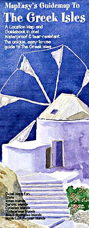
MapEasy edition. Shows all the Greek Islands, neatly separated into island groups, including the: Ionian Islands (east coast), Saronic Islands (south of Athens), Crete (south of Greece), Evia & Sporades Islands (west central coast), Cyclades Islands (between Greece & Turkey), Dodecanese Islands (off Turkey southwest coast), and the Northeast Aegean Islands (off Turkey northwest coast) . Perfect for the intrepid or armchair traveller, this charming map combines the best of a guidebook and a location map, all in one. Printed on tear-proof, water-resistant, lightweight, paper-like plastic, that is incredibly durable. Also includes extensive notations and interesting details about all the important tourist areas. You'll love this map!
Write Your Own Review