
$17.95
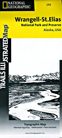
Elias National Park, Road and Recreation Map, Alaska, America. Scale 1:375,000. Size 26"x38". Trails Illustrated edition. This Trails Illustrated topographic map is the most comprehensive recreational map for Alaska's Wrangell - St. Elias National Park & Preserve area. This two-sided map covers Wrangell - St. Elias National Park in its entirety, along with Tetlin National Wildlife Refuge, portions of Chugach National Forest, the Bering Glacier, Kayak Island State Marine Park, Robinson, Chugach, and Wrangell Mountains. Towns include Katalla, Mt. Hazelet, Cape Yakataga, Kennicott, McCarthy, Slana, and Glennallen. The map features two detailed insets: the first includes Yakutat Bay, Disenchantment Bay, Russel Fjord, Nunatak Fjord, and Malaspina Glacier; the second shows the Kennicott and McCarthy areas, Bonanza Ridge, Fireweed Mountain, and the Nizina River.
Write Your Own Review