
$17.95
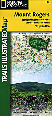
Scale 1:75,000. Size 26"x38". Trails Illustrated edition. Printed on waterproof, tear-resistant, lightweight, paper-like plastic. This Trails Illustrated topographic map is the most comprehensive recreational map for the Mount Rogers National Recreation Area in Virginia. Coverage includes: Jefferson National Forest; Lewis Fork, Little Dry Run, and Little Wildon Creek Wilderness areas; Grayson Highlands, Hungry Mother, and New River Trail State Parks; Appalachian National Scenic Trail, VA Creeper Trail, VA Highlands and Iron Mountain Horse Trails; Towns: Wytheville, Galax, Marion, Damascus, Abingdon.
Write Your Own Review