
South Holston and Watauga Lakes, Road and Recreation Map, Tennessee, America.
$17.95
In stock
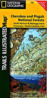
Scale 1:63,000. Size 26"x38". Trails Illustrated edition. Printed on waterproof, tear-resistant, lightweight, paper-like plastic. This Trails Illustrated topographic map is the most comprehensive recreational map for Cherokee National Forest, Northern Districts, South Holston & Watauga Lakes area.
Coverage includes Cherokee National Forest/Northern Districts, Erwin, Elizabethton, Mountain City, Unaka Mountain, Pond Mountain, Big Laurel Branch, Watauga Lake, South Holston Lake, Unaka Mountain Wildlife Viewing Loop, Blue Ridge Parkway, Appalachian National Scenic Trail, Highlands of Roan Mountain, Roan Mountain State Park, Grandfather Mountain Biosphere Reserve, and much more.
| Item Price | $17.95 |
|---|
Write Your Own Review