
Uinta National Forest, Road and Recreation Map, Utah, America.
$17.95
In stock
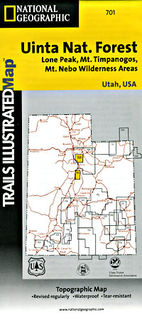
Scale 1:48,000. Size 26"x38". Trails Illustrated edition. Printed on waterproof, tear-resistant, lightweight, paper-like plastic. This Trails Illustrated topographic map is the most comprehensive recreational map for Utah's Uinta National Forest area. Coverage includes Uinta National Forest, Mt. Nebo, Lone Peak and Mt. Timpanogos Wildernesses; Little Provo River, Granite, American Fork, Orem; Little Cottonwood Canyon, Santaquin, Devils Kitchen; Deer Creek and Silver Lake Flat reservoirs.
Scale 1:48,000. Size 26"x38". Trails Illustrated edition. Printed on waterproof, tear-resistant, lightweight, paper-like plastic. This Trails Illustrated topographic map is the most comprehensive recreational map for Utah's Uinta National Forest area. Coverage includes Uinta National Forest, Mt. Nebo, Lone Peak and Mt. Timpanogos Wildernesses; Little Provo River, Granite, American Fork, Orem; Little Cottonwood Canyon, Santaquin, Devils Kitchen; Deer Creek and Silver Lake Flat reservoirs.
| Item Price | $17.95 |
|---|
Write Your Own Review