
Anderson WALL Map, America.
$249.95
In stock
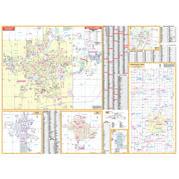
Size 66" W x 50" H. Laminated. Anderson, Indiana, and adjacent areas is a Wall Map by Universal Map. Using up-to-date cartography showing new streets and changes, this map provides complete street detail. The WallMap has been printed in color on a laminated map that is both markable and washable. Streets are indexed on the face of the map. The area of coverage for this map ranges North to the Madison County line; South to the Madison County line; East to Chesterfield; and West to the Madison County line. Insets for this map are as follows: Elwood, Alexandria, Pendleton, Lapel, Madison County, and Anderson University campus. The special features and data contained on this map are as follows: all streets and highways, government buildings, airports, golf courses and country clubs, railroads, ZIP codes and ZIP code boundaries, shopping centers, water features, recreational parks, cemeteries, educational facilities, hospitals, post offices, city limits and annexations, section/township/range lines, fire and police stations, and miscellaneous points of interest. Framing rails are included on top and bottom for easy wall mounting. Railed wall maps can be turned into pull down maps on spring rollers for an additional $40.
Size 66" W x 50" H. Laminated. Anderson, Indiana, and adjacent areas is a Wall Map by Universal Map. Using up-to-date cartography showing new streets and changes, this map provides complete street detail. The WallMap has been printed in color on a laminated map that is both markable and washable. Streets are indexed on the face of the map. The area of coverage for this map ranges North to the Madison County line; South to the Madison County line; East to Chesterfield; and West to the Madison County line. Insets for this map are as follows: Elwood, Alexandria, Pendleton, Lapel, Madison County, and Anderson University campus. The special features and data contained on this map are as follows: all streets and highways, government buildings, airports, golf courses and country clubs, railroads, ZIP codes and ZIP code boundaries, shopping centers, water features, recreational parks, cemeteries, educational facilities, hospitals, post offices, city limits and annexations, section/township/range lines, fire and police stations, and miscellaneous points of interest. Framing rails are included on top and bottom for easy wall mounting. Railed wall maps can be turned into pull down maps on spring rollers for an additional $40.
| Item Price | $249.95 + $24.80 p&h (add $40 for spring rollers) |
|---|
Write Your Own Review