
Antarctica Primary "Classroom" WALL Map Railed.
$139.95
In stock
Size 42"x54". Universal Map edition. Laminated. Details for the Antarctica Primary Classroom Wall Map by Universal Map include mountain peaks, Date Line (Meridian of Greenwich), latitude and longitude lines, Antarctic Circle, South Magnetic Pole, and ice shelves. Measures 54" x 43" and is laminated making the map markable and washable. Mounted with hanging rails top and bottom. This product is ideal for public, private, parochial, and home schools.
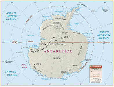
Size 42"x54". Universal Map edition. Laminated. Details for the Antarctica Primary Classroom Wall Map by Universal Map include mountain peaks, Date Line (Meridian of Greenwich), latitude and longitude lines, Antarctic Circle, South Magnetic Pole, and ice shelves. Measures 54" x 43" and is laminated making the map markable and washable. Mounted with hanging rails top and bottom. This product is ideal for public, private, parochial, and home schools.
| Item Price | $139.95 Rolled + $24.80 p&h |
|---|
Write Your Own Review