
Charlotte and Vicinity, North Carolina, America.
$12.95
In stock
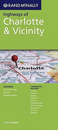
Scale 1:127,000. Size 28"x40". Rand McNally edition. Rand McNally's folded map featuring the highways of Charlotte and vicinity is a must-have for anyone traveling in and around this part of the state, offering unbeatable accuracy and reliability at a great price. Our trusted cartography shows all Interstate, state, and county highways, along with clearly indicated points of interest, airports, county boundaries, and more.You'll see why Rand McNally folded maps have been the trusted standard for years.
Scale 1:127,000. Size 28"x40". Rand McNally edition. Rand McNally's folded map featuring the highways of Charlotte and vicinity is a must-have for anyone traveling in and around this part of the state, offering unbeatable accuracy and reliability at a great price. Our trusted cartography shows all Interstate, state, and county highways, along with clearly indicated points of interest, airports, county boundaries, and more.You'll see why Rand McNally folded maps have been the trusted standard for years.
| Item Price | $10.95 |
|---|
Write Your Own Review