
Charlotte Vicinity WALL Map, North Carolina, America.
$249.95
In stock
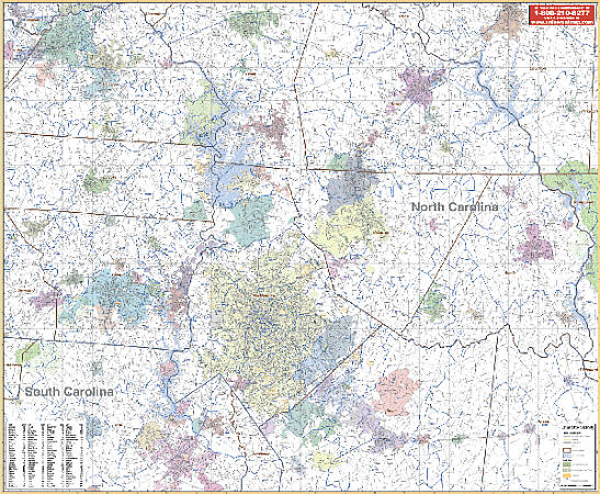
Scale 1:6,625. Size 65" W x 54" H. Laminated. Printed in color with a markable and washable laminated surface. Cities and towns are indexed on the face of the map. Includes hanging rails mounted on top and bottom. Includes the counties of Mecklenburg, Stanly, Cabarrus, Gaston, Lincoln, Catawba & Rowen, and portions of Iredell, Davidson, Union, and Anson Counties including a portion of York County in SC. Boundaries are as follows: North: 40 miles north including Statesville and 55 miles north including Lexington; South: 25 miles southwest to Rock Hill in SC and southeast toMonroe in NC; East: 55 miles east including Denton and Albermarle and 40 miles east including Ansonville; West: 30 miles west including Kings Mountain and 45 miles northwest to Hickory. Details include all major streets and highways, county lines and names, mileage circles, ZIP codes and boundaries, airports, parks, water features, longitude, and latitude lines. Railed wall maps can be turned into pull down maps on spring rollers for an additional $40.
Scale 1:6,625. Size 65" W x 54" H. Laminated. Printed in color with a markable and washable laminated surface. Cities and towns are indexed on the face of the map. Includes hanging rails mounted on top and bottom. Includes the counties of Mecklenburg, Stanly, Cabarrus, Gaston, Lincoln, Catawba & Rowen, and portions of Iredell, Davidson, Union, and Anson Counties including a portion of York County in SC. Boundaries are as follows: North: 40 miles north including Statesville and 55 miles north including Lexington; South: 25 miles southwest to Rock Hill in SC and southeast toMonroe in NC; East: 55 miles east including Denton and Albermarle and 40 miles east including Ansonville; West: 30 miles west including Kings Mountain and 45 miles northwest to Hickory. Details include all major streets and highways, county lines and names, mileage circles, ZIP codes and boundaries, airports, parks, water features, longitude, and latitude lines. Railed wall maps can be turned into pull down maps on spring rollers for an additional $40.
| Item Price | $249.95 + $24.80 p&h (add $40 for spring rollers) |
|---|
Write Your Own Review