
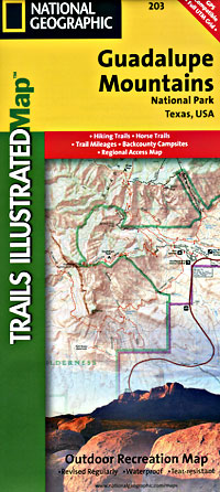
Guadalupe Mountains National Park, Road and Recreation Topographic Map, Texas, America.
$17.95
In stock
Scale 1:35,000. Size 26"x37". Trails Illustrated edition. Printed on waterproof, tear-resistant, lightweight, paper-like plastic. This Trails Illustrated topographic map is the most comprehensive recreational map for Guadalupe National Park in western Texas. Coverage includes Lincoln National Forest, Lonesome Ridge WSA, Devils Den Canyon WSA, McKittrick Canyon WSA, and Guadalupe Mountains Wilderness. UTM grids are provided for use with your GPS unit.
Scale 1:35,000. Size 26"x37". Trails Illustrated edition. Printed on waterproof, tear-resistant, lightweight, paper-like plastic. This Trails Illustrated topographic map is the most comprehensive recreational map for Guadalupe National Park in western Texas. Coverage includes Lincoln National Forest, Lonesome Ridge WSA, Devils Den Canyon WSA, McKittrick Canyon WSA, and Guadalupe Mountains Wilderness. UTM grids are provided for use with your GPS unit.
| Item Price | $17.95 |
|---|
Write Your Own Review