
Highways of Denver, Front Range and Vicinity Street Map, Colorado, America.
$12.95
In stock
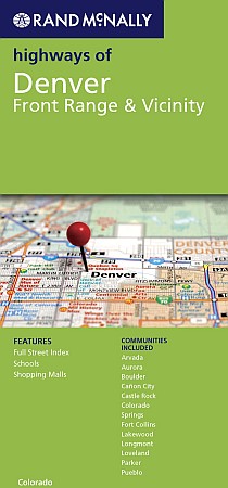
Size 28"x40". Rand McNally edition. This full-color street map of Denver and the Front Range covers a larger area than any of the Denver maps above. It includes Arvada, Aurora, Boulder, Caon City, Castle Rock, Colorado Springs, Fort Collins, Lakewood, Longmont, Loveland, Parker, and Pueblo. The map features Colleges and Universities, Downtown Denver, Golf Courses, Parks and Rec Areas, Places of Interest, and ZIP Codes.
Size 28"x40". Rand McNally edition. This full-color street map of Denver and the Front Range covers a larger area than any of the Denver maps above. It includes Arvada, Aurora, Boulder, Caon City, Castle Rock, Colorado Springs, Fort Collins, Lakewood, Longmont, Loveland, Parker, and Pueblo. The map features Colleges and Universities, Downtown Denver, Golf Courses, Parks and Rec Areas, Places of Interest, and ZIP Codes.
| Item Price | $10.95 |
|---|
Write Your Own Review