
Joshua Tree National Park, Road and Recreation Map, California, America.
$17.95
In stock
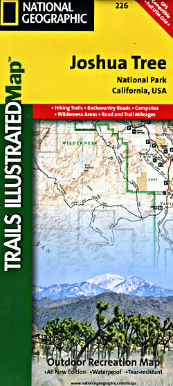
Scale 1:80,000. Size 26"x38". Trails Illustrated edition. Printed on waterproof, tear-resistant, paper-like plastic. Joshua Tree National Park is a fascinating land of surreal geologic features shaped by strong winds, unpredictable torrents of rain, and climatic extremes.
The map includes the Park in its entirety, the Little San Bernardino Mountains, Nexie Mountains, Lost Horse Valley, Quail Springs Historic Trail, Black Rock Canyon, Hidden Valley, Pinto Basin, Chuckwalla Valley, Cottonwood Mountains, Pinto Mountains, Cottonwood Spring Nature Trail, and more. The trails on this map have been enhanced and mileage has been added. Includes UTM grids for use with your GPS unit.
| Item Price | $17.95 |
|---|
Write Your Own Review