
Asia Road Maps | Detailed Travel Tourist Driving
Visit Asia – The Largest Continents of the World with Our Blue Ocean Coated Maps
Asia the biggest and highly populated continents of the world; share its boundaries with Europe and Africa on the West, Oceania on the South, and North America on the East. The Northern portion aids in forming a portion of the Arctic together with North America plus Europe. The majority of its interior borders are visibly defined.
Europe, as well as Asia,isprecisely situated on the similar over all continent and the two together are denoted as Eurasia. Because of its leaky land border, certain countries on the western border of Asia have been sometimes denoted to as a portion of Europe’s East.
Definitely enormous by just almost every degree, the only thread that bonds this assorted continent is the pure assortment of experiences it offers to tourists. Parched deserts and soaring peaks; isolated temples and busy markets; small hamlets and expansive cities; older history and innovative modernism; jam-packed crowds and places so secluded you cannot see another human being about for miles—Asia includes all this besides a lot more.
The secrecies and legends of Asia have captivated mankind for eras. This mystical continent is packed of antique miracles, for example, the huge Buddha of Thailand as well as the Prohibited City of Beijing. Besides, each Asian state is fascinating in its own manner.
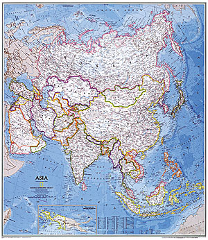
Asia Map
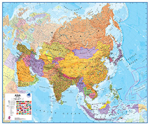
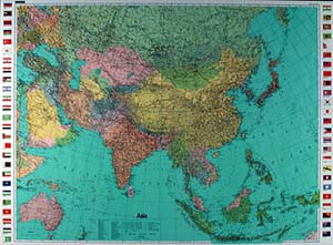
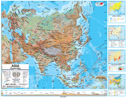
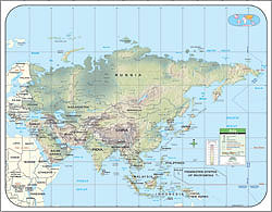
Our map illustrates Asia one among the 7 continents in a Blue Ocean Coated covering. This map displays a combo of political as well as physical features. It incorporates country borders, main cities, main mountains in covered relief, ocean profundity in blue colorslope, together with several other features. This is the best map that you can ever have when you are traveling to any of the Asian countries. It will guide based on the country in which you are.
Asia Road Maps for Tourists and TravelersDetailed Road Map of AsiaBuy travel maps for Asia tourist attractions, road trips, street guide, driving directions and more |
Asia
- $15.95
Item Code : HEMA5096
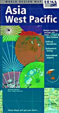
 Scale 1:15,650,000. Size 34"x38". Hema maps edition.
 - $26.95
Item Code : UNIV5097

 Size 36"x48". Universal Map edition. Laminated.
 - $17.95
Item Code : GIZI5098
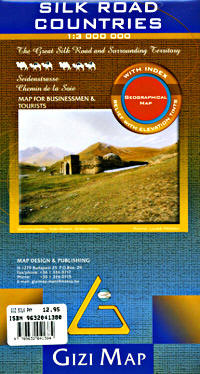
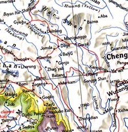
 Scale 1:3,000,000. Size 35"x49" (this is a big map!). Gizi edition. English and multilingual legends. Includes Western China, Turkmenistan, Kyrgyzstan [Kirghizstan], Tajikistan, Uzbekistan, Southern Kazakhstan, Kashmir and Northern India, Pakistan, Afghanistan, Iran, Azerbaijan, Armenia, Georgia, Eastern Turkey, Syria, Iraq, the United Arab Emirates, Northeastern Saudi Arabia, and Northeastern Oman. This is an absolutely beautiful map. Elevation and topographic features are shown by hypsometric color tints.
 - $17.95
Item Code : NELS5099
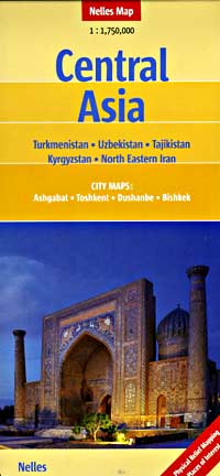
 Scale 1:1,750,000. Size 20"x36" (printed on both sides). Nelles Verlag edition. Covers Kyrgyzstan (Kirghizstan), Tajikistan, Uzbekistan, and Turkmenistan. English and multilingual legends. Also includes inset detailed city street plans of Ashgabat, Tashkent, Dushanbe and Bishkek.
 - $17.95
Item Code : FREY5100
![Central Asia (including Kyrgyzstan [Kirghizstan]) Road and Shaded Relief Tourist Map.](https://maps2anywhere.com/pub/media/catalog/product/f/r/frey-asia-central-road-map-travel-tourist-detailed-cover.jpg)
![Central Asia (including Kyrgyzstan [Kirghizstan]) Road and Shaded Relief Tourist Map.](https://maps2anywhere.com/pub/media/catalog/product/f/r/frey-asia-central-road-map-travel-tourist-detailed-sample.jpg) Scale 1:1,750,000. Size 33"x48" (big map!). Indexed. Freytag-Berndt edition. English and multilingual legends.
Scale 1:1,750,000. Size 33"x48" (big map!). Indexed. Freytag-Berndt edition. English and multilingual legends. - $19.95
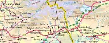
Item Code : REIS5101
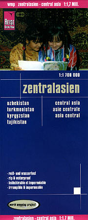
 Scale 1:1,700,000. Size 27"x39". Reis Know How edition. Very detailed Central Asia road map. English and multi-lingual legends. Printed on tear-resistant, waterproof, paper-like plastic. It can bend and fold without cracking and is writable as normal paper, non-toxic and recyclable. Perfect for tourist adventures and independent travel and for driving tours. Includes topographic contour lines and hypsometric color tints which show height levels, along with elevation numbers. Shows all major and secondary roads and tertiary roads, with distances between points in kilometers. Fully indexed. Beautiful cartography.
 - $17.95
Item Code : ITMB5102
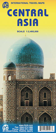
Scale 1:2,400,000. Size 27"x39". International Travel Maps edition.
The collapse of the Soviet Union in the early 1990s created several independent nations in the ‘soft underbelly’ of mother Russia. Thus far, these new nations have been feeling their way into a new, more commercial, reality.
Kazakhstan, Uzbekistan, and Turkmenistan have developed significant tourism potential, and even the more easterly states of Tajikistan and Kyrgyzstan, which are in my opinion the most scenic countries in Central Asia, are proving to be welcoming of exploring visitors.
This is a travel destination unlike any other and this double-sided map, covering from the Aral Sea to the Himalaya chain, is just the map to use to explore this fascinating part of our world. Printed on paper, double-sided
- $17.95
Item Code : GIZI21226
Scale 1:1,750,000. Gizi edition. Discover Central Asia with the colourful Gizi geographical map. The best way to prepare your trip, to plan your itinerary, and to travel independently in Kazakhstan, Kirghizstan, Turkmenistan, Uzbekistan, and Tajikistan. - $29.95 Rolled + $8.80 p&h or $28.80 foreign delivery
Item Code : NATL5103

 Scale 1:13,800,000. Size 33"x38". National Geographic edition. Laminated.
 - $24.95 Rolled + $8.80 p&h or $28.80 foreign delivery
Item Code : NATL5104
 Scale 1:13,800,000. Size 33"x38". National Geographic edition. Not laminated.
 - $22.95 Rolled + $8.80 p&h or $34.80 foreign delivery
Item Code : HEMA5105

 Scale 1:15,650,000. Size 35"x40". Hema maps edition.
 - $44.95 Rolled + $8.80 p&h or $34.80 foreign delivery
Item Code : HEMA5107

 Scale 1:11,000,000. Size 39"x47". Hema maps edition. Laminated. Beautiful map. High quality color. Laminated.
 - $29.95 Rolled + $10.80 p&h or $34.80 foreign delivery
Item Code : HEMA5108
 Scale 1:11,000,000. Size 39"x47". Hema maps edition. Not laminated.
 - $34.95 Rolled + $10.80 p&h or $34.80 foreign delivery
Item Code : KUMR5109
 Scale 1:12,000,000. Size 30"x41". Kummerly and Frey edition.
 - $179.95 Rolled + $24.80 p&h
Item Code : UNIV5110
 Size 54"x64". Universal Map edition. Laminated. The Asia Advanced Physical Classroom Wall Map includes inset maps of annual rainfall, natural vegetation areas, population density, and energy resources and manufacturing areas. The Advanced Physical Classroom Wall Map features innovative shaded relief detail of the world, continents, and the United States. This high quality series is appropriate for grades 6-12, and includes content that meets national and state curriculum standards. Four thematic inset maps enhance the value of the main map. The world map features the Van Der Grinten projection. Wall maps measure 64" x 54." Mounted on roller with backboard. This product is ideal for public, private, parochial, and home schools.
 - $179.95 Rolled + $24.80 p&h
Item Code : UNIV5111
 Size 54"x64". Universal Map edition. Laminated. The Asia Advanced Political Classroom Wall Map features four insets: Climate; Energy, Manufacturing, and Trade; Population Density; and Natural Vegetation and Environment. Mounted on roller with backboard. The Advanced Political Classroom Wall map series provides a wealth of valuable information including country and state boundaries as well as capitals, major waterways, and major cities. Created with legibility in mind these brightly colored maps highlight the world, its continents, and the United States with detailed cartography. Appropriate for grades 6-12 and satisfying state and national curriculum standards, the Advanced Political Classroom Wall Map is a must have for every classroom. Wall maps measure 64" x 54: This product is ideal for public, private, parochial, and home schools.
 - $179.95 Rolled + $24.80 p&h
Item Code : UNIV5112
 Size 43"x54". Universal Map edition. Laminated. This Asia Primary classroom Wall Map by Universal Map features laminated surfacing which is markable and washable, color coded countries, and measurements of 54" W x 43" H. Ranges: North: to the Barents Sea and the Arctic Ocean; South: to Indonesia; East: to the East Bering Sea, Pacific Ocean; West: to Ukraine, Turkey. Details include national capitals, national boundaries, Tropic of Cancer, cities, latitude and longitude lines, Equator, mountain peaks, and the Date Line. Mounted on roller with backboard. This product is ideal for public, private, parochial, and home schools.
 - $139.95 Rolled + $24.80 p&h
Item Code : UNIV5113
 Size 42"x54". Universal Map edition. Laminated. The Wall Map of Asia by Universal Map features laminated surfacing, which is markable and washable, color-coded countries, and measurements of 54" by 42". The range on this map travels north to the Barents Sea and the Arctic Ocean, south to Indonesia, east to the East Bering Sea and Pacific Ocean, and West to Ukraine and Turkey. Details include national capitals, national boundaries, Tropic of Cancer, cities, latitude and longitude lines, Equator, mountain peaks, and the Date Line. This product is ideal for public, private, parochial, and home schools.
| Postage and handling is $4.40 for the first map and $1.80 for each additional map. ~ ~ ~ ~ ~ ~ Foreign delivery is $15.80 for the first map and $7.60 for each additional map. ~ ~ ~ ~ ~ ~ Canada delivery is $15.80 for the first map and $7.60 for each additional map. |
Visit Asia – The Largest Continents of the World with Our Blue Ocean Coated Maps
Asia the biggest and highly populated continents of the world; share its boundaries with Europe and Africa on the West, Oceania on the South, and North America on the East. The Northern portion aids in forming a portion of the Arctic together with North America plus Europe. The majority of its interior borders are visibly defined.
Europe, as well as Asia,isprecisely situated on the similar over all continent and the two together are denoted as Eurasia. Because of its leaky land border, certain countries on the western border of Asia have been sometimes denoted to as a portion of Europe’s East.
Definitely enormous by just almost every degree, the only thread that bonds this assorted continent is the pure assortment of experiences it offers to tourists. Parched deserts and soaring peaks; isolated temples and busy markets; small hamlets and expansive cities; older history and innovative modernism; jam-packed crowds and places so secluded you cannot see another human being about for miles—Asia includes all this besides a lot more.
The secrecies and legends of Asia have captivated mankind for eras. This mystical continent is packed of antique miracles, for example, the huge Buddha of Thailand as well as the Prohibited City of Beijing. Besides, each Asian state is fascinating in its own manner.
Asia Map
Our map illustrates Asia one among the 7 continents in a Blue Ocean Coated covering. This map displays a combo of political as well as physical features. It incorporates country borders, main cities, main mountains in covered relief, ocean profundity in blue colorslope, together with several other features. This is the best map that you can ever have when you are traveling to any of the Asian countries. It will guide based on the country in which you are.
Asia Road Maps for Tourists and TravelersDetailed Road Map of AsiaBuy travel maps for Asia tourist attractions, road trips, street guide, driving directions and more |
