
Kansas Road Maps | Detailed Travel Tourist Driving
|
Kansas Road Maps |
Kansas
- $14.95
Item Code : GRTA9698
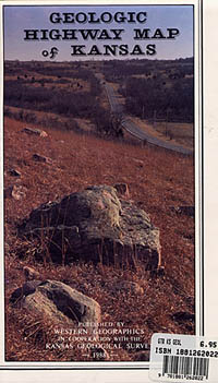
 Scale 1:1,000,000. Size 24"x37". GTR Mapping Company edition.
 - $11.95
Item Code : UNIV22799
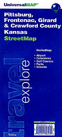
Universal Map edition. This map of Kansas and Missouri is durably laminated and contains extensive coverage. Laminated maps are easy to fold, write on, and wipe off. Coverage includes insets of: Kansas City, Topeka, and Wichita, in KS; and Cape Girardeau, Columbia, Jefferson City, Joplin, Kansas City, Springfield, St. Joseph, and St. Louis, in MO; and features: Airports, Campgrounds, Interstate Exit Numbers, Latitude and Longitude information, Parks and Rec Areas, Places of Interest, and Scenic Routes and Trails. - $11.95
Item Code : RAND22798
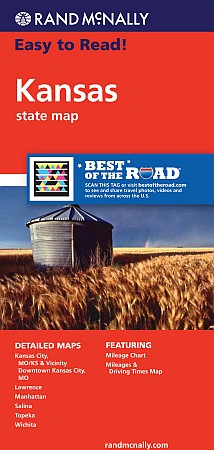 Size 28"x40". Rand McNally edition. A good, detailed, paper road map of Kansas. Includes inset city maps of Hutchinson, Kansas City, MO/KS & Vicinity, Downtown Kansas City, MO; Lawrence, Manhattan, Salina, Topeka, and Wichita.
 - $27.95 + $7.50 p&h or $28.50 foreign delivery
Item Code : DELR9700

 Scale 1:203,000. Full size, 11x15?". 80 pages. DeLorme edition. Designed for those who want to get off the beaten path, this atlas shows all types of roads and tracks, cities, towns, hamlets, and provides topographic maps that show hiking trails, campgrounds, fishing spots, ski areas, and more. Contains a guide to state and national parks and recreation areas, historic sites, and unique natural areas. Comprehensive index enables the user to find locations quickly and easily. Great for car or backpack! Saddle-stitched, durable laminated paper cover.
 - $259.95 + $24.80 p&h
Item Code : RAND9701
 Scale 1:820,000. Size 60" W x 46" H. Laminated. Rand McNally's regional wall map of Kansas is ideal for anyone needing a comprehensive representation of the area for planning, routing, or reference. It's a great choice for business and sales strategy, urban development, social work outreach, education, and marketing. Kansas residents, businesses, and government offices are sure to find this wonderful reference tool irreplaceable. ?The laminated wall map is printed with UV-resistant ink to help prevent color fading. ?Map details include state highways, federal highways, county highways, county boundaries, city shading, cities and towns, major waterways, state/national parks, campsites, exit numbers, rest areas, military installations, airports, golf courses, universities, and much more. ?You'll also find a city/county index on the map, a mileage chart with 900 mileage pairs between 30 cities, and a driving times map between major cities in the region. ?This truly complete wall map even includes a hanging kit with rails for easy mounting just about anywhere. Inset maps include: Hutchinson; Kansas City & Vicinity; Kansas City, MO downtown; Lawrence; Manhattan; Salina; Topeka; Wichita.
 - $249.95 + $24.80 p&h (add $40 for spring rollers)
Item Code : UNIV9702
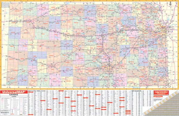 Scale 1:100,000. Size 61" W x 42" H. Laminated. Printed in color with a markable and washable laminated surface. Cities and counties are indexed on the face of the map. Special features include color coded counties and a mileage chart between major cities. Details include all state and federal highways, major waterways, state universities, military installations, major airports, state parks and wildlife areas, cities, towns, and points of interest. Framing rails are included on top and bottom for easy wall mounting. Railed wall maps can be turned into pull down maps on spring rollers for an additional $40.
 - $10.95
Item Code : RLEY9703

 Scale 1:21,000. Size 23"x35". Riley Marketing edition.
 - $10.95
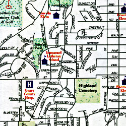
Item Code : UNIV22800
 Universal Map edition. This full-color street map of Kansas City, KS/MO includes: Gladstone, Lake Waukomis, North Kansas City, Parkville, Riverside, and Weatherby Lake; and features: Airports, Block Numbers, Colleges and Universities, Golf Courses, Parks and Rec Areas, Places of Interest, and ZIP
 - $11.95
Item Code : UNIV22802
 Universal Map edition. This map of Kansas City, KS-MO is durably laminated and contains extensive coverage. Laminated maps are easy to fold, write on, and wipe off. Coverage includes street-detail insets of: Country Club Plaza, Downtown Kansas City (MO), Rockhurst University, the University of Missouri at KC, Airports, Golf Courses, Hospitals, Parks and Rec Areas, and Places of Interest.
 - $229.95 + $24.80 p&h (add $40 for spring rollers)
Item Code : UNIV9706
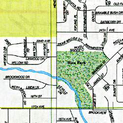
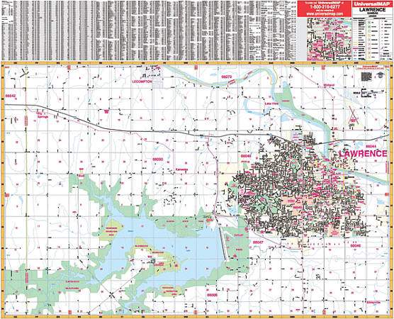 Scale 1:1,850. Size 54" W x 41" H. Laminated. Provides up-to-date cartography with new streets and changes. Printed in color with a markable and washable laminated surface. Streets are indexed on the face of the map. Framing rails are included on top and bottom for easy wall mounting. Area of coverage: North: to North 2100 Rd., including part of Lecompton; South: to North 950 Rd., including the Rockhaven Recreation Area; East: to the Douglas-Leavenworth County line; West: 1 mile West of the Douglas-Schawnee County line. Includes inset of Downtown Lawrence. Details provided: airports, cemeteries, hospitals, railroads, post offices, points of interest, all streets and highways, shopping centers, recreational parks, mileage circles, city limits and annexations, government buildings, fire and police stations, educational facilities, golf and country clubs, ZIP codes and boundaries, and longitude/latitude lines. Railed wall maps can be turned into pull down maps on spring rollers for an additional $40.
 - $10.95
Item Code : RLEY9707

 Scale 1:19,750. Size 19"x25". Riley Marketing edition.
 - $10.95
Item Code : UNIV9709
 Size 23"x35". Universal Map edition.
 - $10.95
Item Code : RAND9710
 Scale 1:37,000. Size 28"x40". Rand McNally edition. Detailed city street map.
 - $10.95
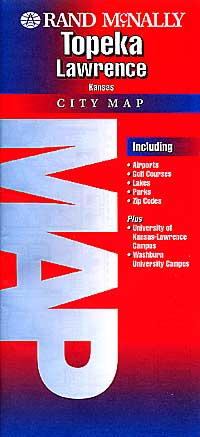
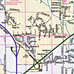
Item Code : UNIV22801
Universal Map edition. This full-color street map of Topeka and Lawrence, KS includes an inset of Topeka and a Lawrence area map; and features: Airports, Colleges and Universities, Golf Courses, Hospitals, Parks and Rec Areas, Places of Interest, Schools, and ZIP Codes. - $249.95 + $24.80 p&h (add $40 for spring rollers)
Item Code : UNIV9711
Scale 1:2,350. Size 54" W x 56" H. Laminated. Contains up-to-date cartography with new streets and changes, printed in color, laminated, indexed on the face of the map, with framing rails on top and bottom for easy wall mounting. Map coverage: North: to the Jackson/Shawnee County line; South: to include Auburn and Wakarusa; East: to 1 mile east of the Shawnee-Douglas County line; West: to Silver Lake. Includes an inset of Downtown Topeka. Details include all streets, post offices, hospitals, railroads, mileage circles, longitude and latitude lines, airports, cemeteries, shopping centers, water features, recreational parks, government buildings, fire and police stations, educational institutions, golf and country clubs, ZIP codes and boundaries, and section, township, and range lines. Framing rails are included on top and bottom for easy wall mounting. Railed wall maps can be turned into pull down maps on spring rollers for an additional $40. - $10.95
Item Code : RAND9713

 Scale 1:44,000. Size 26"x37". Rand McNally edition. Detailed city street map.
 - $249.95 + $24.80 p&h (add $40 for spring rollers)
Item Code : UNIV9715
 Size 70" W x 54" H. Laminated. The 1st edition Wichita, Kansas and Vicinity Wall Map published by Universal Map has expanded coverage with up-to-date cartography. Printed in color with a markable and washable laminated surface. Cities and towns indexed on the face of the map. Hanging rails mounted top and bottom. Area of coverage: North: 40 miles from Wichita to include Nickerson and Hesston; South; 50 miles from Wichita to include Caldwell, Hunnewell, and Arkansas City; East: 45 miles from Wichita to the Chautauqua and Elk County line; West: 65 miles from Wichita to include Nashville, Cunningham, and Turon. Includes the following counties: Sedgwick, Reno, Harvey, Butler, Kingman, Harper, Sumner, and Cowley.Details include major streets and highways, airports, parks, county lines, mileage circles, longitude/latitude, water features, ZIP codes/boundaries, and points of interest. Railed wall maps can be turned into pull down maps on spring rollers for an additional $40.
 - $229.95 + $24.80 p&h (add $40 for spring rollers)
Item Code : UNIV9716
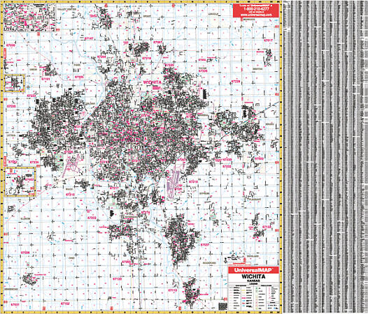 Size 60" W x 54" H. Laminated. The Wichita, Kansas Wall Map by Universal Map, uses complete street detail, up-to-date cartography, color, and a markable and washable laminated surface. Streets are indexed on the face of the map. Framing rails are included. Includes the cities and towns of Benton, Rose Hill, Mulvane, Clearwater, Goddard, and Colwich. Boundaries: North: Includes the city of Valley Center; South: Includes Mulvane; Sedgwick/Sumner Co. line; East: includes the cities of Benton, Andover, and Rose Hill. West: Includes Colwich. Insets: Colwich, Goddard, Downtown Wichita. Details included: all streets and highways, water features, shopping centers, recreational parks, points of interest, mileage circles, longitude and latitude, government buildings, fire and police stations, educational facilities, golf courses and country clubs, city limits and annexations, ZIP codes and boundaries, section/township/range lines, airports, hospitals, railroads, post offices, and cemeteries. Railed wall maps can be turned into pull down maps on spring rollers for an additional $40.
|
Kansas Road Maps |
