
Louisiana Road Maps | Detailed Travel Tourist Driving
|
Louisiana Road Maps |
Louisiana
- $10.95
Item Code : MSUP9882
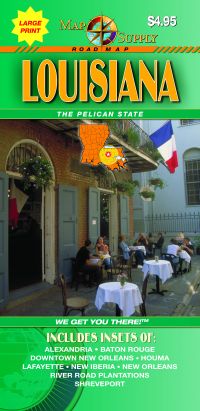
 Scale 1:680,000. Size 27"x36". Map Supply edition.
 - $11.95
Item Code : UNIV9883
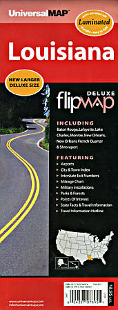
 Scale 1:890,000. Size 11"x30". Universal Map edition. Laminated.
 - $10.95
Item Code : UNIV9884
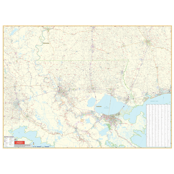
 Various scales. Size 24"x36". Universal Map edition.
 - $27.95 + $7.50 p&h or $28.50 foreign delivery.
Item Code : DELR9891
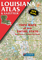
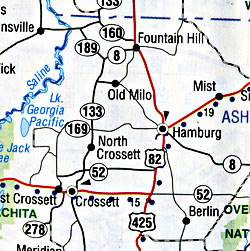
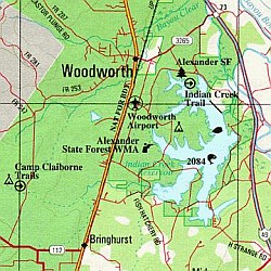 Scale 1:184,000. Full size, 11x15?". 64 pages. DeLorme edition. Designed for those who want to get off the beaten path, this atlas shows all types of roads and tracks, cities, towns, hamlets, and provides topographic maps that show hiking trails, campgrounds, fishing spots, ski areas, and more. Contains a guide to state and national parks and recreation areas, historic sites, and unique natural areas. Comprehensive index enables the user to find locations quickly and easily. Great for car or backpack! Saddle-stitched, durable laminated paper cover.
 - $11.95
Item Code : RAND22815
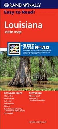 Rand McNally maps edition. Rand McNally's trusted cartography shows all Interstate, U.S., state, and county highways, along with clearly indicated parks, points of interest, airports, county boundaries, and streets. The map includes inset city maps of Alexandria, Baton Rouge, Lafayette, Lake Charles, Monroe, New Orleans & Vicinity, Downtown New Orleans, and Shreveport.
 - $259.00 Shipped rolled in a tube + $24.80 p&h
Item Code : RAND9887
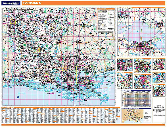 Scale 1:507,000. Size 46"x60". Rand McNally edition. Laminated. Professional Grade. Rand McNally's regional wall map of Louisiana is ideal for anyone needing a comprehensive representation of the area for planning, routing, or reference. It's a great choice for business and sales strategy, urban development, social work outreach, education, and marketing. Louisiana residents, businesses, and government offices are sure to find this wonderful reference tool irreplaceable. ?The laminated wall map is printed with UV-resistant ink to help prevent color fading. ?Map details include state highways, federal highways, county highways, county boundaries, city shading, cities and towns, major waterways, state/national parks, campsites, exit numbers, rest areas, military installations, airports, golf courses, universities, and much more. ?You'll also find a city/county index on the map, a mileage chart with 900 mileage pairs between 30 cities, and a driving times map between major cities in the region. ?This truly complete wall map even includes a hanging kit with rails for easy mounting just about anywhere. Inset maps include: Alexandria, Baton Rouge, Lafayette, Lake Charles, Monroe, New Orleans & Vicinity, New Orleans downtown, and Shreveport.
 - $249.95 + $24.80 p&h (add $40 for spring rollers)
Item Code : UNIV9888
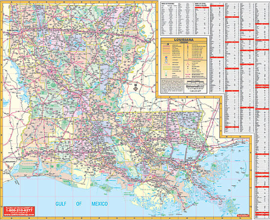 Scale 1:570,000. Size 60" W x 50" H. Laminated. The Louisiana State Wall Map by Universal Map illustrates color-coded parishes with the parish name. The special features and data are as follows: all state and federal highways, major waterways, towns, military installations, major airports, state universities, cities, state parks, wildlife areas, and various points of interest. Printed in color with a markable and washable laminated surface. Framing rails are included on top and bottom for easy wall mounting. Railed wall maps can be turned into pull down maps on spring rollers for an additional $40.
 - $10.95
Item Code : UNIV22820
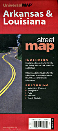
Universal Map edition. - $10.95
Item Code : RAND9892
 Scale 1:38,000. Size 26"x37". Rand McNally edition. Detailed city street map.
 - $10.95
Item Code : UNIV9893
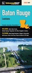
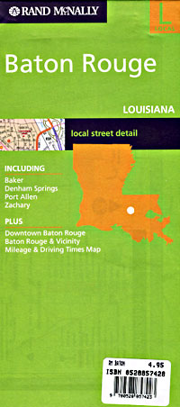
 Scale 1:44,000. Size 27"x39". Universal Map edition. This full-color street map of Baton Rouge, LA includes: Addis, Baker, Brusly, Denham Springs, Plaquemine, Port Allen, Slaughter, and Zachary; and features: Baton Rouge Downtown, Colleges and Universities, Golf Courses, Parks and Rec Areas, Places of Interest, and ZIP
 - $11.95
Item Code : UNIV9894

 Scale 1:45,000. Size 23"x26". Universal Map edition. Laminated.
 - $249.95 + $24.80 p&h (add $40 for spring rollers)
Item Code : UNIV9897
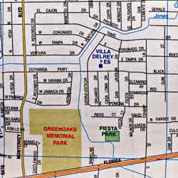
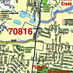
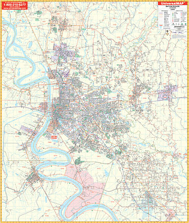 Scale 1:2,816. Size 60" W x 70" H. Laminated. The 5th edition Baton Rouge, Louisiana Wall Map with adjacent areas by Universal Map. Provides up-to-date cartography with new streets and changes. Printed in color with a markable/washable-laminated surface. Streets indexed on map's face. Hanging rails mounted top and bottom. NEW FEATURE: Expanded east 6 miles & expanded south 7 1/2 miles. Area of coverage: All of Baton Rouge with the following boundaries: North: Zachary & Feliciana Parish line; South: Includes Carville, Bayou Goula in Iberville Parish, Gonzalez & Sorrento in Ascension Parish; East: Denham Springs, Walker in Livingston Parish; West: Carey, Brusly, Addis, Port Allen, and Plaquemine. Details include airports, all streets/highways, government buildings, cemeteries, shopping centers, golf/country clubs, hospitals, water features, educational facilities, railroads, recreational parks, longitude/latitude, post offices, ZIP codes/boundaries, mileage circles, city limits/annexations, and points of interest. Railed wall maps can be turned into pull down maps on spring rollers for an additional $40.
 - $249.95 + $24.80 p&h (add $40 for spring rollers)
Item Code : UNIV9898
 Scale 1:290,000. Size 72" W x 54" H. Laminated. The 2nd edition Baton Rouge Vicinity, Louisiana Wall Map by Universal Map. Printed in color with a markable/washable-laminated surface. Cities indexed on the map's face. Includes hanging rails mounted top and bottom. Area of Coverage: the Gulf of Mexico coastal area from Mobile, Alabama to New Orleans, Louisiana with the following boundaries: North: 70 miles to Brookhave, MS; South East: 85 miles to New Orleans; East:130 miles to include Gulfport and Biloxi, MS; West: 70 miles to include Lafayette. Details include all highways/interstates, mileage circles, ZIP codes/boundaries, airports, longitude/latitude lines, water features, city limits/annexations, and state parks. Railed wall maps can be turned into pull down maps on spring rollers for an additional $40.
 - $10.95
Item Code : UNIV9899
 Scale 1:16,000. Size 24"x38". Universal Map edition.
 - $10.95
Item Code : UNIV9905
 Scale 1:39,000. Size 24"x37". Universal Map edition.
 - $10.95
Item Code : RAND9906
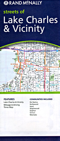
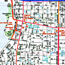 Scale 1:34,000. Size 28"x40". Rand McNally edition. Detailed city street map.
 - $229.95 + $24.80 p&h (add $40 for spring rollers)
Item Code : UNIV9904
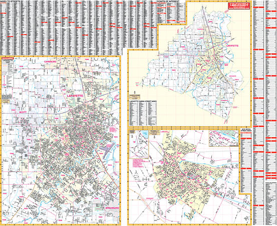 Scale 1:2,114. Size 65" W x 54" H. Laminated. The Lafayette, Louisiana Wall Map by Universal Map. Shows all of Lafayette Parish in complete street detail. Contains a laminated surface that is both markable and washable. Indexed on the face of the map. Framing rails are included on top and bottom for easy wall mounting. Measures 65" x 54." Uses up-to-date cartography with new streets and changes. Includes a laminated surface that is both markable and washable. Area of coverage that ranges as follows: North: to Gloria Switch Road, SR98; South: to Southside Regional Park & Fortune Rd.; East: to the Lafayette Regional Airport; West: to the town of Scott. Insets: New Iberia. The special features and data are as follows: all streets and highways, government buildings, airports, golf courses and country clubs, railroads, longitude and latitude lines, ZIP codes/boundaries, shopping centers, recreational parks, mileage circles, cemeteries, educational facilities, hospitals, post offices, city limits and annexations, fire and police stations, and miscellaneous points of interest. Railed wall maps can be turned into pull down maps on spring rollers for an additional $40.
 - $249.95 + $24.80 p&h (add $40 for spring rollers)
Item Code : UNIV9907
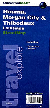
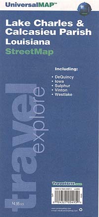
 Scale 1:2,413. Size 50" W x 67" H. Laminated. The 2nd Edition Lake Charles and Calcasieu Parish, Louisiana Wall Map by Universal Map providing up-to-date cartography in complete street detail with new streets and changes. This map has been printed in color with a markable and washable laminated surface. Streets are indexed on the face of the map. This map's area of coverage is as follows: Section 1--Lake Charles and Sulphur (at a scale of 1' = 2,413 feet)--North: 1 mile north of Sam Houston State Park; South: to Lake Charles Regional Airport; East: to Chenault International Airport; West: to the city limits of Sulphur. Section 2--Calcasieu Parish with the balance of streets. Insets for this map include Vinton, Dequincy, and Iowa. The special features and data contained on this map are as follows: all streets and highways, government buildings, airports, golf courses and country clubs, railroads, longitude and latitude lines, ZIP codes and ZIP code boundaries, shopping centers, recreational parks, mileage circles, cemeteries, educational facilities, hospitals, post offices, city limits and annexations, fire and police stations, section/township/range lines, longitude and latitude lines, and miscellaneous points of interest. Framing rails are included on top and bottom for easy wall mounting. Railed wall maps can be turned into pull down maps on spring rollers for an additional $40.
 - $10.95
Item Code : UNIV9908
Universal Maps edition. Detailed city street map. - $10.95
Item Code : RAND9909
Rand McNally edition. Detailed city street map.
|
Louisiana Road Maps |
