
Minnesota Road Maps | Detailed Travel Tourist Driving
|
Minnesota Road Maps |
Minnesota Road Maps
- $10.95
Item Code : UNIV10620
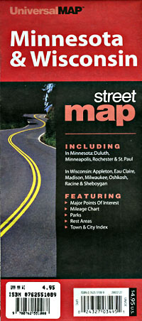
 Various scales. Size 24"x36". Universal Map edition. Minnesota road map.
 - $27.95 + $7.50 p & h or $28.50 foreign delivery
Item Code : DELR10625
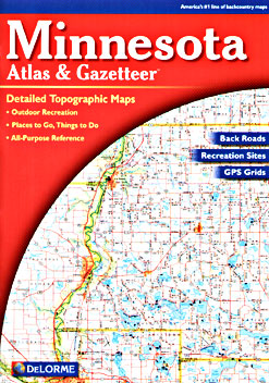
 Scale 1:190,000. Full size, 11"x15?". 96 pages. Delorme Mapping edition. Designed for those who want to get off the beaten path, this atlas shows all types of roads and tracks, cities, towns, hamlets, and provides topographic maps that show hiking trails, campgrounds, fishing spots, ski areas, and more. Contains a guide to state and national parks and recreation areas, historic sites, and unique natural areas. Comprehensive index enables the user to find locations quickly and easily. Great for car or backpack! Saddle-stitched, durable laminated paper cover.
 - $259.95 + $24.80 p&h
Item Code : RAND10626
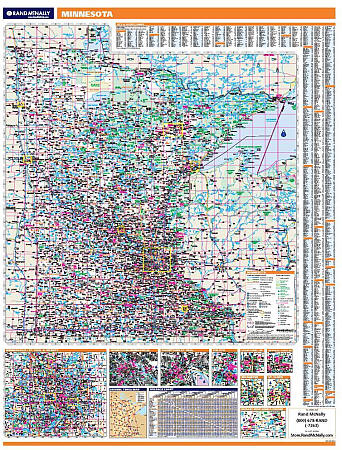 Scale 1:1,000,000. Size 60" W x 46" H. Laminated. Rand McNally's regional wall map of Minnesota is ideal for anyone needing a comprehensive representation of the area for planning, routing, or reference. It's a great choice for business and sales strategy, urban development, social work outreach, education, and marketing. Minnesota residents, businesses, and government offices are sure to find this wonderful reference tool irreplaceable. ?The laminated wall map is printed with UV-resistant ink to help prevent color fading. ?Map details include state highways, federal highways, county highways, county boundaries, city shading, cities and towns, major waterways, state/national parks, campsites, exit numbers, rest areas, military installations, airports, golf courses, universities, and much more. ?You'll also find a city/county index on the map, a mileage chart with 900 mileage pairs between 30 cities, and a driving times map between major cities in the region. ?This truly complete wall map even includes a hanging kit with rails for easy mounting just about anywhere. Inset maps include: Duluth; Mesabi Iron Range Region; Minneapolis/St. Paul & vicinity; Minneapolis downtown; Moorhead/Fargo, ND; Grand Forks, ND; Rochester; St. Cloud; and St. Paul downtown.
 - $249.95 + $24.80 p&h (add $40 for spring rollers)
Item Code : UNIV10627
 Scale 1:820,000. Size 54" W x 64" H. Laminated. Printed in color with a markable and washable laminated surface. Hanging rails are mounted top and bottom for ease in hanging. Cities and counties are indexed on the face of the map. Special features include color-coded counties and a mileage chart between major cities. Details include all state highways, all federal highways, secondary roads, cities and towns, major airports, major waterways, state universities, military installations, state and national parks, and historic sites. Railed wall maps can be turned into pull down maps on spring rollers for an additional $40.
 - $16.95
Item Code : NATL10679

 Scale 1:70,000. Size 26"x38". National Geographic edition.
 - $16.95
Item Code : NATL10680
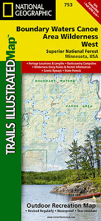
 Scale 1:70,000. Size 26"x38". National Geographic edition. The water-rich Superior National Forest includes more than 2,000 lakes and rivers that offer a chance to canoe, boat, fish and camp where early Native Americans, voyagers, missionaries, loggers and explorers once traveled. About a third of the Forest lies within the Boundary Waters Canoe Area Wilderness (BWCAW). Visitors to the BWCAW will find a sense of solitude and primitive recreation; permits are required and special regulations apply. The Boundary Waters was recognized for recreational opportunities in 1926, named the Superior Roadless Area in 1938, the BWCA in 1958, and federally designated under The Wilderness Act in 1964. It wasn’t until October 21, 1978, The Boundary Waters Canoe Area Wilderness Act was established to provide specific guidance for managing the million plus acres of the Superior National Forest. The BWCAW has changed little since the glaciers melted. With over 1,500 miles of canoe routes, nearly 2,200 designated campsites, and more than 1,000 lakes and streams waiting, the BWCAW draws over 250,000 visitors each year. As part of the Superior National Forest, the BWCAW is managed by the US Forest Service. Coverage Highlights: Hiking trails, portages, cross-country, snowmobile and snowshoe trails, trail access locations, campgrounds and tent sites, birding, fishing, kayak, canoeing and power boating opportunities; Ash River, Crane Lake, Kabetogama and Rainy Lake Visitor Centers; Park Attractions: Gull Island Rookery, Grassy Bay Cliffs, Anderson Bay, Kettle Falls, Hoist Bay, Gold Portage.
 - $16.95
Item Code : NATL10681
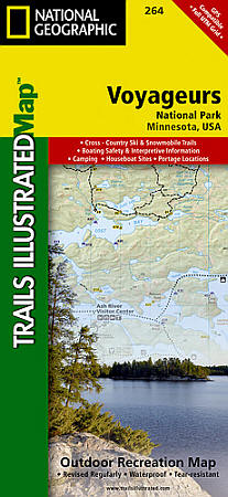
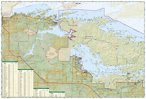 Scale 1:70,000. Size 26"x38". National Geographic edition. Located at the border of Minnesota and Canada, Voyageurs National Park is frequented by over million visitors each year. Defined by its interconnected waterways, the park requires you to leave your car behind and explore the Northwood Lake Country by kayak, canoe, houseboat, or motorboat. Our new Trails Illustrated map for Voyageurs National Park was developed in cooperation with local land managers, ensuring that it is the most accurate and up-to-date available. Like all Trails Illustrated Maps, Voyageurs is printed in the USA on waterproof, tear-resistant, material—a necessity for the water based activities in the park. Our Voyageurs map contains detailed park information for all seasons, including hiking trails, campgrounds, portages, snowshoe trails, snowmobiling trails, trail access points, detailed roads, park services, plus opportunities for boating, fishing, kayaking, power boating, and more. Coverage Highlights: Park Attractions: Gull Island Rookery, Grassy Bay Cliffs, Anderson Bay, Kettle Falls, Hoist Bay, Gold Portage; Ash River, Crane Lake, Kabetogama and Rainy Lake Visitor Centers; Hiking trails, portages, cross-country, snowmobile and snowshoe trails, trail access locations, campgrounds and tent sites, birding, fishing, kayak, canoeing and power boating opportunities.
 - $10.95
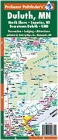
Item Code : ROCK10684
Scale 1:35,000. Rockwell Enterprises edition. - $10.95
Item Code : RAND10685
 Scale 1:40,000. Size 23"x29". Rand McNally edition.
 - $11.95
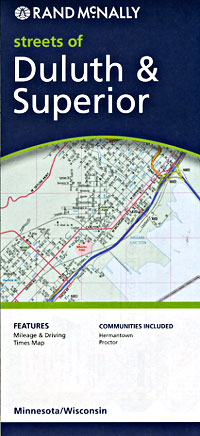
Item Code : HBRG22901
 Hedberg Maps edition. This is a handy, compact format. Includes a street map of most of the city of Duluth, a building-level detail of downtown Duluth, a street map of Superior, Wisconsin, and a handy map of the North Shore area.
 - $10.95
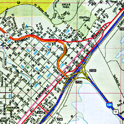
Item Code : RAND10688
Scale 1:21,000. Rand McNally edition Minnesota map of road tourist - $10.95
Item Code : RAND10690
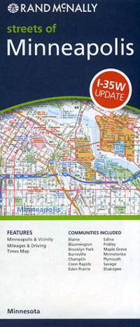
 Scale 1:37,000. Size 28"x39". Rand McNally edition. m
 - $10.95
Item Code : RAND10691
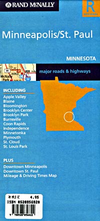
 Paul, Minnesota, America. Scale 1:159,000. Size 27"x38". Rand McNally edition.
 - $10.95
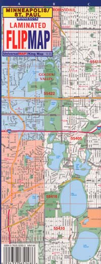
Item Code : UNIV10692
 Paul "Flipmap" Minnesota, America. Scale 1:45,000. Size 12"x26". Universal Map edition. Laminated.
 - $10.95
Item Code : UNIV10693
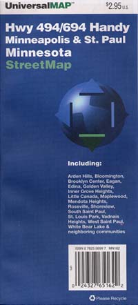
 Paul "Handy map" Minnesota, America. Scale 1:38,000. Size 28"x40". Universal Map edition.
 - $10.95
Item Code : UNIV10694
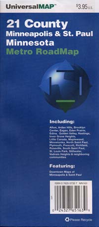
 Paul "Metro" Minnesota, America. Scale 1:155,000. Size 27"x39". Universal Map edition.
 - $11.95
Item Code : RAND22892
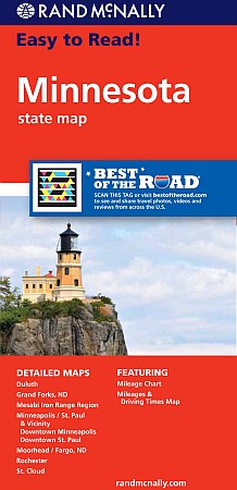 Rand McNally edition. Rand McNally's Easy To Read State Folded Map is a must-have for anyone traveling in and around Minnesota, offering unbeatable accuracy and reliability at a great price. Our trusted cartography shows all Interstate, U.S., state, and county highways, along with clearly indicated parks, points of interest, airports, county boundaries, and streets. The easy-to-use legend and detailed index make for quick and easy location of destinations. You'll see why Rand McNally folded maps have been the trusted standard for years. 40% larger map with a bigger type size than the Rand McNally Folded Map Clearly labeled Interstate, U.S., state, and county highways Indications of parks, points of interest, airports, county boundaries, and more Mileage and driving times map Detailed index Convenient folded size Detailed maps of: Duluth, Grand Forks, ND; Mesabi Iron Range Region, Minneapolis/St. Paul & Vicinity, Downtown Minneapolis, Downtown St. Paul, Moorhead/Fargo, ND; Rochester, St. Cloud.
 - $10.95
Item Code : HBRG22895
 Hedberg Maps edition.
 - $24.95
Item Code : HUDS10695
Hudson Map Company edition. - $10.95
Item Code : HBRG22896
Hedberg Maps edition.
|
Minnesota Road Maps |
