
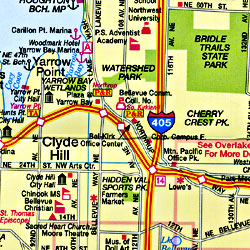
Washington Road Maps | Detailed Travel Tourist Driving
|
Washington Road Maps |
Washington State
- $14.95
Item Code : GMJO8547
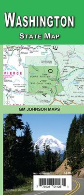
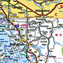
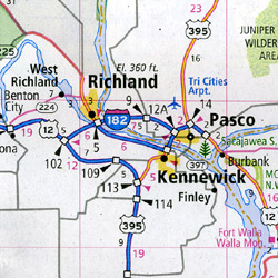
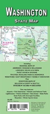 Scale 1:870,000. Size 22"x34". G.M. Johnson edition. This Map Coverage Area are Aberdeen, Hoquiam, Bellingham, Puget Sound, Spokane, Tri-Cities: Richland & Pasco & Kennewick, Wenatchee, East Wenatchee, Yakima, Vancouver, Longview, Kelso, Olympia, Bellevue, Everett, Seattle, Spokane, Tacoma.
 - $12.95
Item Code : GMJO19372
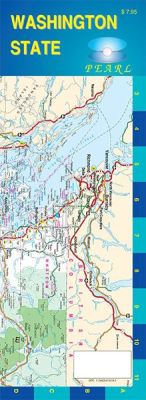
 Scale 1:1,200,000. Size 11"x24". G.M. Johnson edition. Laminated.
 - $16.95
Item Code : NATL19371
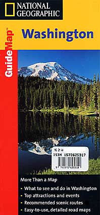
 Scale 1:1,200,000. Size 18"x25". National Geographic edition. The front side features insets of Olympia, Yakima and Spokane. The back includes a map and information for Seattle, information for Olympic, North Cascades, and Mt. Rainier National Parks, points of interest, scenic drives, and Park Service sites in Washington.
 - $12.95
Item Code : GMJO19368
 Scale 1:1,000,000. Size 27"x39". G.M. Johnson edition. Aberdeen, Hoquiam, Bellingham, Puget Sound, Spokane, Tri-Cities: Richland & Pasco & Kennewick, Wenatchee, East Wenatchee, Yakima, Vancouver, Longview, Kelso, Olympia, Bellevue, Everett, Seattle, Spokane, Tacoma.
 - $12.95
Item Code : GMJO19369
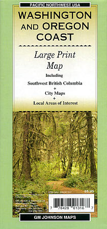
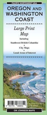 "Various scales". Size 27"x39". G.M. Johnson edition. Washington Coast, Oregon Coast, Southwest British Columbia
 - $11.95
Item Code : RAND19370
 Scale 1:850,000. Size 26"x37". Rand McNally edition.
 - $12.95
Item Code : MART19373
 Scale 1:975,000. Size 28"x40". MapArt edition.
 - $29.95 + $7.50 p&h or $28.80 foreign delivery
Item Code : BENC19381
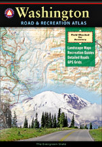
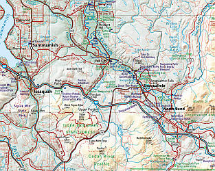 Scale 1:200,000. Size 11"x16". 128 pages. Indexed. Benchmark Maps edition. Spectacular shaded relief cartography. Lots of wonderful information for recreation and outdoors enjoyment. This atlas is designed for for people who need an authoritative reference to the natural beauty, culture, and history of the American West. Nowhere else will the camper, boater, traveler, or armchair explorer find a more comprehensive guide and travel companion. At the heart of this atlas are the richly detailed Landscape Maps?, compiled by skilled cartographers using the latest digital technologies. They are simply the clearest, the most beautiful, and the most up to date of any now published. Much more than a collection of maps. these maps are so three-dimensional you can feel every bump in the road as well as every foothill, mountain and fault; plus more listings and a complete and seemingly infallible index." Every atlas contains a wealth of factual information, including locations, web sites, hours, and phone numbers for campgrounds, natural wonders, museums, historic sites, and more. We go to the trouble to field check and verify our data, then organize it for convenience and intuitive ease of use. Benchmark's leadership status in state atlas publishing is your assurance that you'll find cartographic and editorial excellence within our covers.
 - $12.95
Item Code : BENC19404
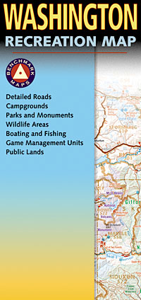
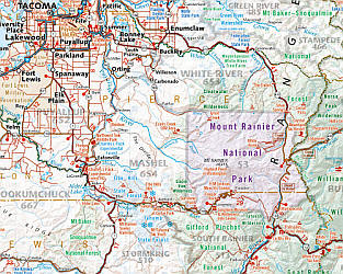 Scale 1:650,000. Size 27"x38". Benchmark Maps edition.
 - $27.95 + $7.50 p & h or $32.50 foreign delivery
Item Code : DELR19380
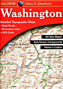
 Scale 1:150,000. Full size, 11"x15?". 104 pages. DeLorme Publishers edition. Designed for those who want to get off the beaten path, this atlas shows all types of roads and tracks, cities, towns, hamlets, and provides topographic maps that show hiking trails, campgrounds, fishing spots, ski areas, and more. Contains a guide to state and national parks and recreation areas, historic sites, and unique natural areas. Comprehensive index enables the user to find locations quickly and easily. Great for car or backpack! Saddle-stitched, durable laminated paper cover.
 - $259.00 Shipped rolled in a tube + $24.80 p&h
Item Code : RAND19377
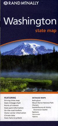
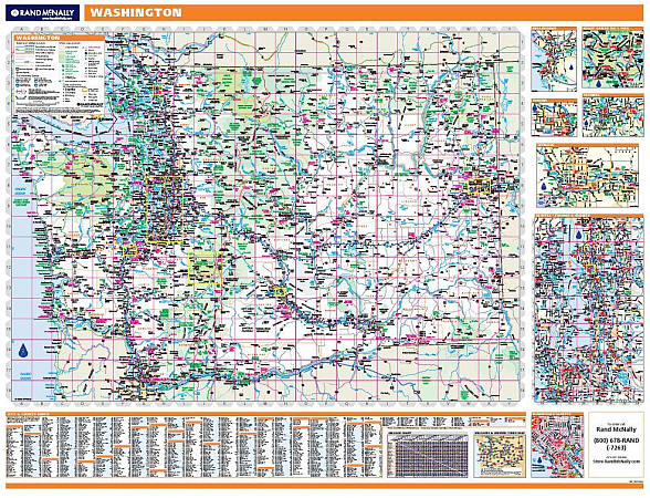 Scale 1:507,000. Size 46"x60". Rand McNally edition. Laminated. Professional Grade. Rand McNally's regional wall map of Washington is ideal for anyone needing a comprehensive representation of the area for planning, routing, or reference. It's a great choice for business and sales strategy, urban development, social work outreach, education, and marketing. Washington residents, businesses, and government offices are sure to find this wonderful reference tool irreplaceable. ?The laminated wall map is printed with UV-resistant ink to help prevent color fading. ?Map details include state highways, federal highways, county highways, county boundaries, city shading, cities and towns, major waterways, state/national parks, campsites, exit numbers, rest areas, military installations, airports, golf courses, universities, and much more. ?You'll also find a city/county index on the map, Rand McNally Express Access Codes for more information online, and a driving times map between major cities in the region. ?This truly complete wall map even includes a hanging kit with rails for easy mounting just about anywhere. Inset maps include: Bellingham, Mt. Rainier National Park, Yakima, Olympia, Spokane, Seattle & Vicinity, and Downtown Seattle.
 - $249.95 + $24.80 p&h (add $40 for spring rollers)
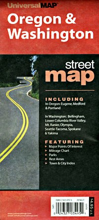
Item Code : UNIV19378
 Scale 1:740,000. Size 62" W x 42" H. Laminated. Printed in color with a markable, washable, and laminated surface. Includes hanging rails mounted top and bottom. Cities and counties are indexed on the face of the map. Special features include color-coded counties and a mileage chart between major cities. Details include all state highways, all federal highways, secondary roads, cities and towns, major airports, major waterways, state universities, military installations, county populations, state and national parks, ski areas, and points of interest. Railed wall maps can be turned into pull down maps on spring rollers for an additional $40.
 - $10.95
Item Code : UNIV19374
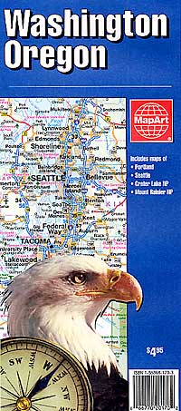
 "Various scales". Size 24"x36". Universal Map edition.
 - $16.95
Item Code : NATL19383
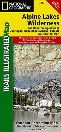
 Scale 1:75,000. Size 26"x38". National Geographic edition. One of five Trails Illustrated maps for the Washington Cascades region offering the most detailed and up-to-date map for the forest, carefully researched and developed in co-operation with local land managers and agencies. Each map contains easy to read trails, numbered forest service roads, campsites, access points, scenic points-of-interests, and important facilities. More than 700 lakes and mountain ponds fill practically every low spot in the glacier-carved terrain of Alpine Lakes Wilderness. Valleys thick with trees give way to rocky ridges and rugged peaks along the crest of the Cascades, some slopes permanently cloaked with snowfields. Diverse is the word that best describes the Alpine Lakes: from wet forests of Douglas fir, cedar, and western hemlock understoried with salal and berries at lower elevations on the western side; to true firs and mountain hemlock opened by extensive meadows matted with low growth; to the crest and 180 inches of precipitation per year (largely as snow); countered by spruce, whitebark pine, and larch on the eastern side; and ending farther down with a dry forestland of ponderosa pine and lodgepole pine understoried by grasses and dampened by as little as 10 inches of annual precipitation. The Pacific Crest National Scenic Trail (PCT) enters from Stevens Pass on the north to follow the crest south, with a long westward bend to Snoqualmie Pass, a distance of 67 trail miles. Hordes of people take advantage of the PCT's 450 miles or so of excellent trails. Subsequent use and abuse of the area has resulted in a permit system, which is applied to some regions of the Wilderness between June 15 and October 15. No dogs are permitted, and campfires are banned above 5,000 feet. Coverage includes: Pacific Crest Trail, Cle Elum, Kachess & Keechelus Lakes, Wenatchee River, Deception Falls, Stevens Pass Greenway Wilderness Coverage: Alipine Lakes. Other Attractions: Hiking Trails, Mountain Biking, Scenic Back Roads, Boat Ramps, Mountain Climbing, Sno-Parks, Ski Areas, Fishing, Snowmobile Trails.
 - $16.95
Item Code : NATL20979
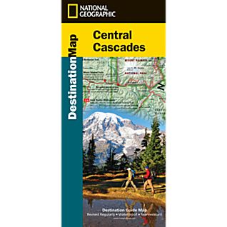
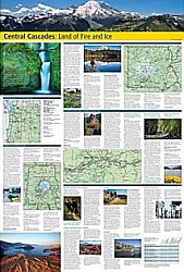 Scale 1:764,000. Size 26"x38". National Geographic edition. National Geographic’s Cascades Destination Map strikes the perfect balance between map and guidebook and is an ideal resource for touring this culturally and geographically unique region in Washington and Oregon in the Pacific Northwest. The front features a large-scale map of the region, along with travel tips and weather information. The reverse includes inset maps and descriptions of Mount Rainier National Park, Columbia River Gorge National Scenic Area, and Crater Lake National Park, along with information about birding and wildlife viewing, biking, hiking and mountain climbing, fishing, and winter sports.
 - $10.95
Item Code : 19384
Cascade Mountains, Road and Recreation Map, Washington, America (please turn to "North Cascades National Park, Road and Recreation Map, Washington, America") - $16.95
Item Code : NATL19386
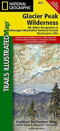
 Scale 1:75,000. Size 26"x38". National Geographic edition. One of five new Trails Illustrated maps for the Washington Cascades region offering the most detailed and up-to-date map for the forest, carefully researched and developed in co-operation with local land managers and agencies. Each map contains easy to read trails, numbered forest service roads, campsites, access points, scenic points-of-interests, and important facilities. The Glacier Peak Wilderness, created by Congress in the 1964 Wilderness Legislation, is located within portions of Chelan, Snohomish, and Skagit Counties in the northern Cascade Mountains of Washington State. The area, 576,900 acres in size, is characterized by heavily forested stream courses, steep-sided valleys, and dramatic glacier crowded peaks. Forest vegetation is comprised of true firs, spruce, and hemlock, as well as stands of pine on its eastern slopes. Various species of wildlife inhabit the area and include deer, elk, bear, mountain goat, cougar, marten, and lynx. The primary fishery is cutthroat trout, however, other species do exist there as well. Recreation opportunities, as well as solitude abound with more than 450 miles of trail and many places where one can enjoy cross-country travel. Because of the popularity of the area, there have been some restrictions put in place in order to protect its unique wilderness character. Coverage includes: Noisy Diobsud Wilderness Area, Mount Baker National Recreation Area, Skagit Wild & Scenic River, Mount Baker, Mountain Loop & North Cascades Scenic Byways Wilderness Coverage: Mount Baker, Boulder River, Noisy Diobsud. Other Attractions: Mount Pilchuck & Wallace Falls State Parks, Baker & Spada Lakes, Lake Shannon, Hiking Trails, Mountain Biking, Scenic Back Roads, Boat Ramps, Mountain Climbing, Sno-Parks, Ski Areas, Fishing, Snowmobile Trails, Cross-Country Skiing, Waterfalls, Day Use Areas, Dispersed Camping Areas, Picnic Areas, Campgrounds.
 - $16.95
Item Code : NATL19387
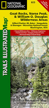
 Scale 1:75,000. Size 26"x38". National Geographic edition. The Gifford Pinchot National Forest, located in southwest Washington State, is one of the oldest National Forests in the United States. Coverage Highlights: William O. Douglas and Tatoosh Wilderness Areas, Pacific Crest Trail, Bumping and Rimrock Lakes, Manastash Ridge & Tatoosh Range, Chinook and White Pass Scenic Byways. Wilderness Coverage: Goat Rocks, Norse Peak, Tatoosh, William O. Douglas. Other Attractions: Hiking Trails, Mountain Biking, Campgrounds, Scenic Back Roads, Mountain Climbing, Sno-Parks, Fishing.
 - $10.95
Item Code : GPAC19388
 "Various scales". Size 12"x27". Great Pacific Recreation Maps edition. Laminated.
 - $12.95
Item Code : GMJO19389

 Scale 1:380,000. Size 27"x39". G.M. Johnson edition. This Map Coverage Area are Spokane, Selkirk Mountains, Palouse, Blue Mountains, Lake Pend Oreille, Coeur D’alene Lake, Lewiston-Clarkston, Camas Prairie, Hells Canyon, Silver Valley, Northern Idaho, Eastern Washington.
|
Washington Road Maps |
