
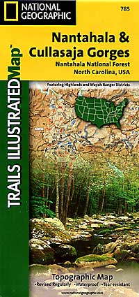
Nantahala and Cullasaja Gorges, Road and Recreation Map, North Carolina, America.
$17.95
In stock
Scale 1:70,000. Size 26"x38". Trails Illustrated edition. Printed on waterproof, tear-resistant, paper-like plastic. This Trails Illustrated topographic map is the most comprehensive recreational map for the Nantahala & Cullasaja Gorges area of North Carolina. Coverage includes: Nantahala National Forest - Nantahala & Cullasaja Gorges area; Ellicott Rock and Middle Prong Wilderness Areas; Blue Ridge Parkway; Chattooga Wild and Scenic River; towns of Franklin, Sylva, Highlands, and Cashiers.
Scale 1:70,000. Size 26"x38". Trails Illustrated edition. Printed on waterproof, tear-resistant, paper-like plastic. This Trails Illustrated topographic map is the most comprehensive recreational map for the Nantahala & Cullasaja Gorges area of North Carolina. Coverage includes: Nantahala National Forest - Nantahala & Cullasaja Gorges area; Ellicott Rock and Middle Prong Wilderness Areas; Blue Ridge Parkway; Chattooga Wild and Scenic River; towns of Franklin, Sylva, Highlands, and Cashiers.
| Item Price | $17.95 |
|---|
Write Your Own Review