
Prince William Sound West Road and Recreation Map, Alaska, America.
$17.95
In stock
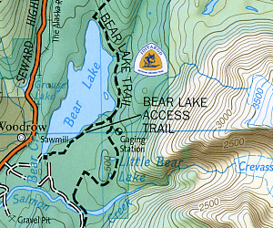
Scale 1:110,000. Size 26"x38". Trails Illustrated edition. This Trails Illustrated topographic map is the most comprehensive recreational map for Alaska's Prince William Sound - West area. Coverage includes Chugach National Forest, Nellie Juan-College Fjord Wilderness Study Area, Granite Bay, South Esther Island, Surprise Cove, Decision Point, Entry Cove, Ziegler Cave and Bettles Bay state marine parks. Whittier and Chenega. Knight, Latouche, Elrington, Evans, Bainbridge, Culross, Esther and Perry islands; Port Wells, Port Nellie Juan and Port Bainbridge; Harriman, College and Blue fjords. Includes selected anchorages and kayak landings.
Scale 1:110,000. Size 26"x38". Trails Illustrated edition. This Trails Illustrated topographic map is the most comprehensive recreational map for Alaska's Prince William Sound - West area. Coverage includes Chugach National Forest, Nellie Juan-College Fjord Wilderness Study Area, Granite Bay, South Esther Island, Surprise Cove, Decision Point, Entry Cove, Ziegler Cave and Bettles Bay state marine parks. Whittier and Chenega. Knight, Latouche, Elrington, Evans, Bainbridge, Culross, Esther and Perry islands; Port Wells, Port Nellie Juan and Port Bainbridge; Harriman, College and Blue fjords. Includes selected anchorages and kayak landings.
| Item Price | $17.95 |
|---|
Write Your Own Review